1467 views | Public | French
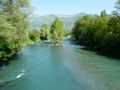
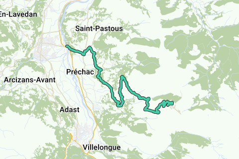
The classic climb to Hautacam from Argelès-Gazost. Starting from Argelès-Gazost (465 m.), the climb to Hautacam (1560 m.) is 15.8 km long. Over this distance, the climb is 1170 m. (an average of 6.8%), with some short sections at 10%. The 2008 Tour de France finish is at a height of 1520 m.
Navigate route in...
![]() RouteYou app Open
RouteYou app Open
![]()
Please wait, your print is being prepared.
Your print is ready to download. Have fun on the road!
Processing your request has failed. Please try again.
![]()
Please wait, your download is being prepared.
Your download is ready. Have fun on the road!
Processing your request has failed. Please try again.
<iframe src="https://plugin.routeyou.com/routeviewer/free/?language=en&params.route.id=1189832" width="100%" height="600" frameborder="0" allowfullscreen></iframe>
<a href="https://www.routeyou.com/en-fr/route/view/1189832/road-bike-route/climb-to-hautacam?utm_source=embed&utm_medium=article&utm_campaign=routeshare" title="Climb to Hautacam - RouteYou" target="_blank"><img src="https://image.routeyou.com/embed/route/960x670/1189832-en@2x.png" width="960" height="670" alt="Climb to Hautacam"></a>
Additional feedback:
Try this feature for free with a RouteYou Plus trial subscription.
If you already have such an account, then log in now.
Try this feature for free with a RouteYou Premium trial subscription.
© 2006-2024 RouteYou - www.routeyou.com