Source: Responsible?
Droits d'auteur: Creative Commons 3.0
384 vues | Publique
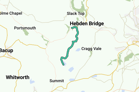
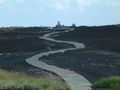
The Pennine Way is a National Trail in England, with a small section in Scotland. The trail runs 267 miles (429 km) from Edale, in the northern Derbyshire Peak District, north through the Yorkshire Dales and the Northumberland National Park and ends at Kirk Yetholm, just inside the Scottish border. The path runs along the Pennine hills, sometimes described as the "backbone of England". Although not the United Kingdom's longest National Trail (this distinction belongs to the 630-mile (1,014 km) long South West Coast Path), it is according to the Ramblers' Association "one of Britain's best known and toughest".
More info on Wikipedia Wikipedia and Openstreetmap.
Inspired by OSM.
Roads 
Appropriateness as Walking route: 

Paved:  (48.17% - 4 km unpaved)
Traffic load:  (low traffic)
Noise pollution: 
Landscape Characteristics
Nature landscape: 
Urbanized area: 
Near water: 
Dominant direction( ) :36%
  :27%
:27%  :13%
:13%  :16%
:16%
Above analysis can contain errors because of missing or incomplete information in our database. Help us improve the score of this route by answering the questions on following link.
Parcourir l'itinéraire dans...
![]() Application RouteYou Ouvrez
Application RouteYou Ouvrez
Plus voir cette annonce?
→ Améliorez maintenant
![]()
Veuillez patienter, la navigation est en cours de préparation.
Vous pouvez maintenant naviguer. Amusez-vous en route!
Le traitement de votre requête a échoué. S'il vous plaît réessayez.
Plus voir cette annonce?
→ Améliorez maintenant
![]()
Veuillez patienter, votre téléchargement est en cours de préparation.
Votre téléchargement est prêt. Amusez-vous en route!
Le traitement de votre requête a échoué. S'il vous plaît réessayez.
Plus voir cette annonce?
→ Améliorez maintenant
![]()
Veuillez patienter, votre impression est en cours de préparation.
Votre impression est prête à être téléchargée. Amusez-vous en route!
Le traitement de votre requête a échoué. S'il vous plaît réessayez.
Plus voir cette annonce?
→ Améliorez maintenant
![]()
Veuillez patienter, votre téléchargement est en cours de préparation.
Votre téléchargement est prêt. Amusez-vous en route!
Le traitement de votre requête a échoué. S'il vous plaît réessayez.
<iframe src="https://plugin.routeyou.com/routeviewer/free/?language=fr&params.route.id=4385922&params.language=en" width="100%" height="600" frameborder="0" allowfullscreen></iframe>
<a href="https://www.routeyou.com/en-gb/route/view/4385922/walking-route/pennine-way-warland-reservoir-to-calder-valley?utm_source=embed&utm_medium=article&utm_campaign=routeshare" title="Pennine Way (Warland Reservoir to Calder Valley) - RouteYou" target="_blank"><img src="https://image.routeyou.com/embed/route/960x670/4385922-en@2x.png" width="960" height="670" alt="Pennine Way (Warland Reservoir to Calder Valley)"></a>
Commentaires supplémentaires:
Essayez cette fonctionnalité gratuitement avec un abonnement d'essai RouteYou Plus.
Si vous avez déjà un tel compte, connectez-vous maintenant.
Essayez cette fonctionnalité gratuitement avec un abonnement d'essai RouteYou Premium.
© 2006-2024 RouteYou - www.routeyou.com