1929 views | Public | Dutch
Loop of 18 km through the Bloso domain Hofstade: The LONGEST loop that you can make within the boundaries of the nature / recreation domain, without having to walk / walk / cycle the same path 1 time!
This loop is a slight extension (and slight modification) of the 12km loop (https://www.routeyou.com/nl/route/view/551957/wandelroute-blosodomein-hofstade-12km-lus-start-aan-ingang-weerde.nl).
To obtain a loop of 14km, an additional extension has been made by including the Finnish Piste (900m), the classified bathhouse on the beach side is 'visited' three times along different paths, and the canal is followed on its north side, south of the Boathouse, until past the old swimming pool, which is then followed further on its south side, Only to return a little later to a final stretch of asphalt.
A total of 14km in forest: A real unique in the wide area around Zemst and Mechelen.
100% traffic-free, 65% in the forest, You can walk more than 90% of the roads on unpaved soil. Take advantage of trailers!
Details highlighted (see also the 12km loop):
1. In the Blos domain, all water features are passed as long as possible: along the largest pond, the beach is passed three times (1x on the beach building to the north, 1x on the passerel southwards, and a 3rd time back north on the beach -along the water- to the end of the beach (the last part is forbidden swimming zone). There is then a return next to the concrete beach road along the sand to the beach building, after which a right turn is made along the beach road to the northwest exit - which is not yet taken but where the canal is taken to the right. This moat is then passed on both sides, then one passes a fairly enclosed unknown eastern forest pond, then integrally along the three rectangular eastern ponds with an intermediate channel, and to finish another piece of the moat in the forest, and the crossing in a northerly direction between the two largest ponds (where at the end the right pond is followed separately).
2. Nowhere is kwasie crossed the same path twice.
3. Variety of surfaces:
-->Walking strips: The two large ponds are paved in dolomite gravel, the canal has clinker strips alongside, At the beach building and the former swimming pool along the canal (between bath building and sports hotel) asphalt / concrete. Kwasie everywhere there are along unpaved grass or sand strips;
--> sand strips on the Plage;
-->Finnish Piste with its typical wood chip surface;
-->Mountain-bike trails that occasionally run bumpy and winding through the forest. In wet weather, pecertain strips can be slippery and soggy;
-->Straight strips under the coniferous trees with an extremely soft coniferous bottom with some pine apples.
The new (illuminated) Finnish Piste of about 900m can be used as a walk-through on soft surfaces, and you can also use the fit-o-meter that has been set up.
Note: The loop runs additionally through the paying beach section. If you are outside the summer season or in bad weather, no access and identity check is required.
If you are from the KASTZE police zone and the weather is warm: please bring your identity card. If you come from further afield, you pay a symbolic entrance to keep out amok makers; or take the 10km freely accessible loop.
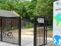
Departure and arrival of the GPS loop is near the entrance from Weerde (northwest side, on the side of the swimming pool / station of Hofstade).
Look here for the opening hours of this access: https://www.routeyou.com/location/view/47513809/noordwestingang-blosodomein-hofstade-langs-station-met-openingsuren.nl . Parking for Zemstenaars at the pool opposite this entrance. If you come from far away, take the southern or eastern parking lot.
If you do not use GPS for your navigation, print this route (via 'download'), and also print this POI, because you will not find a map with the correct existing paths anywhere in this eastern part:
https://image.routeyou.com/shrink/fit/1006x930/f7f48a846ddedeb8e0cfd8058263a1af_984cd131eec4c2667b120020e799850dda420025.jpg
Open this map in a separate TAB in your browser (new TAB, then copy/paste), so you can easily print it on an A4 sheet (File/print preview).
On this POI you notice that you can start the loop in 7 other places.
Difficult point: At the north of forest near the northeast exit, take a left and follow the railway line west to the old closure of the Bloso domain. Follow this to the left (leave the track), and follow the first rectangular pond on your left for 50m (the fence on the right against the pond is open in one place). At the end, this walk is occupied over 20m with thorn bushes. The more people who get through here, the better and easier this passage is. In the end you have to go under a gate.
Take a left there and move between the current and next rectangular pond.
Repeat this 2 times until you have been along the east side of the easternmost pond.
Then you follow the canal further in a northwesterly direction, and further the closure of the paying part of the domain. Then, along the central road between the two largest ponds, return to the departure point.
If you want a different loop in this domain, take a look here (at the bottom of the map, or click on the 'Routes' tab): https://www.routeyou.com/nl/group/view/6181/blosodomein-hofstade.nl#c=50.98777299552499;4.5095050402422885&z=14
Do you want to know more about this domain? See http://www.bloso.be/centra/hofstade/Pages/Home.aspx
Navigate route in...
![]() RouteYou app Open
RouteYou app Open
Don't want to see this ad anymore?
→ Upgrade now
![]()
Please wait, the navigation is being prepared.
You can now navigate. Have fun on the road!
Processing your request has failed. Please try again.
Don't want to see this ad anymore?
→ Upgrade now
![]()
Please wait, your download is being prepared.
Your download is ready. Have fun on the road!
Processing your request has failed. Please try again.
Don't want to see this ad anymore?
→ Upgrade now
![]()
Please wait, your print is being prepared.
Your print is ready to download. Have fun on the road!
Processing your request has failed. Please try again.
Don't want to see this ad anymore?
→ Upgrade now
![]()
Please wait, your download is being prepared.
Your download is ready. Have fun on the road!
Processing your request has failed. Please try again.
<iframe src="https://plugin.routeyou.com/routeviewer/free/?language=en&params.route.id=802405" width="100%" height="600" frameborder="0" allowfullscreen></iframe>
<a href="https://www.routeyou.com/en-be/route/view/802405/walking-route/blosodomein-hofstade-18km-loop-the-allerlangste-starts-at-the-weerde-entrance?utm_source=embed&utm_medium=article&utm_campaign=routeshare" title="Blosodomein Hofstade, 18km loop (the ALLERlangste), starts at the Weerde entrance. - RouteYou" target="_blank"><img src="https://image.routeyou.com/embed/route/960x670/802405-en@2x.png" width="960" height="670" alt="Blosodomein Hofstade, 18km loop (the ALLERlangste), starts at the Weerde entrance."></a>
Additional feedback:
Try this feature for free with a RouteYou Plus trial subscription.
If you already have such an account, then log in now.
Try this feature for free with a RouteYou Premium trial subscription.
© 2006-2024 RouteYou - www.routeyou.com