Link copied. Paste the link into Instagram to share the route.

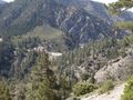
Il Sentiero Silver Moccasin è un sentiero di 53 miglia (85 km) situato nelle montagne di San Gabriel, appena a nord-est di Los Angeles. Inizia nell'Area Ricreativa di Chantry Flat sopra la città di Arcadia, California, attraversando verso l'alto e verso il basso attraverso diversi canyon e lungo le alte creste della Foresta Nazionale degli Angeles. Questo sentiero collega il Monte Baden-Powell, il Monte Burnham, il Throop Peak e il Monte Hawkins. Raggiunge il suo punto più alto di 9.399 piedi (2.865 m) al Monte Baden-Powell, dopo di che scende verso il suo termine a Vincent Gap sulla Angeles Crest Highway vicino a Wrightwood.
Ispirato da OSM.
See something wrong on this route?Add an issue
Navigate route in...
 RouteYou app Open
Don't want to see this ad anymore?
→ Upgrade now

Please wait, the navigation is being prepared.
You can now navigate. Have fun on the road!
Processing your request has failed. Please try again.
Don't want to see this ad anymore?
→ Upgrade now
Please wait, your download is being prepared.
Your download is ready. Have fun on the road!
Processing your request has failed. Please try again.
Don't want to see this ad anymore?
→ Upgrade now
Please wait, your print is being prepared.
Your print is ready to download. Have fun on the road!
Processing your request has failed. Please try again.
Additional feedback:
This feature is only available to RouteYou PREMIUM subscribers.
Try 1 month for free and discover the difference! We don't take any payment details, and your trial ends automatically after one month.
© 2006-2026 RouteYou - www.routeyou.com


 Recreational USA & Canada




 Start
 Download
 Download


