The Chiricahua Mountains massif is a large mountain range in southeastern Arizona which is part of the Basin and Range province of the west and southwestern United States and northwest Mexico; the range is part of the Coronado National Forest. The highest point, Chiricahua Peak, rises 9,759 feet above sea level, approximately 6,000 feet above the surrounding valleys. The range takes its name from the Chiricahua Apaches native to the region.
The Chiricahua Mountains, and other associated ranges, along with Sulphur Springs Valley on the west and the San Simon Valley on the east, form the eastern half of Cochise County in southeast Arizona. The Pedregosa Mountains are found at the southern end of the Chiricahua Mountains, while the Swisshelm Mountains are located to the southwest. The northwest end of the Chiricahua mountains continue as the Dos Cabezas Mountains beyond Apache Pass and the Fort Bowie National Historic Site. Access to the Chiricahua Mountains and Coronado National Forest is through Willcox from the north, Douglas from the south, and Rodeo from the east.
Source: Wikipedia.org
Droits d'auteur: Creative Commons 3.0
Cochise, États-Unis
Découvrez les itinéraires les plus jolis et les plus populaires de la région, soigneusement regroupés dans des sélections appropriées.
Source: BAlvarius
Droits d'auteur: Creative Commons 3.0
Découvrez les lieux d'intérêt les plus jolis et les plus populaires de la région, soigneusement regroupés dans des sélections appropriées.
Source: BAlvarius
Droits d'auteur: Creative Commons 3.0
Avec RouteYou, il est facile de créer ses propres cartes personnalisées. Il vous suffit pour cela de tracer votre itinéraire, d'ajouter des points de passage ou des jonctions, d'inclure des lieux d'intérêt et des bars/restaurants pour une petite pause et de partager cet itinéraire avec votre famille et vos amis.
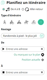
Planificateur d'itinéraires

<iframe src="https://plugin.routeyou.com/poiviewer/free/?language=fr&params.poi.id=1460762&params.language=en" width="100%" height="600" frameborder="0" allowfullscreen></iframe>
Essayez cette fonctionnalité gratuitement avec un abonnement d'essai RouteYou Plus.
Si vous avez déjà un tel compte, connectez-vous maintenant.
© 2006-2024 RouteYou - www.routeyou.com