2762 vues | Publique | Néerlandais
In addition to the village center of Nederokkerzeel, the hamlet "Laar", one of the oldest extractions, was the most important district of the village with the same intensive parcelling (subdivision) and buildings as clearly shown by the Ferraris map of 1777. According to Verbesselt, this district was created in the 9th century, which even had an independent development, separate from the St. Michael's Abbey. Traditionally, the territory of Laar belonged to the allodial or own possession of the counts of Leuven, the later dukes of Brabant. Their power was legally based on the so-called "regalia rights" whereby the duke had the exclusive right over forests, heaths, driesen and meadows, according to ancient custom. The name "Laar" refers to a clearing in a meadow or forest.
The name could also be derived from the family "de Lare", which used to have a fief here. A second possibility would be that this family was called "de Lare" after the place name. Later in the 13th century, "Laar" was transferred to Kortenberg Abbey, which collected the tithes. In the course of the 16th century, "Laar" developed into an independent lordship, under the management of the Lords of Nossegem and the "de Keyzer" family. Then the van Leefdaal family (1690).
From the lease of 1256 drawn up by knight Franco we learn an accurate description of the first Court of List, which would belong to the abbey of St. Michael after the death of the couple.
When this court was demolished in the 17th century, a castle was built, which is described as "huys van List". It served the stewards or provisors, usually religious of the abbey, as a residence.
On Friday, September 30, 1796, the French proceeded to requisition buildings and contents of Lister Huys.
Later it came into the hands of Baron Charles Vanderlinden
d ́High prince, who had it broken down and filled the locks. Only the Mustard pond remained.
A few beautiful hooves of the area are still preserved, Liststraat no. 24 and 26.
Source: kampenhout.be
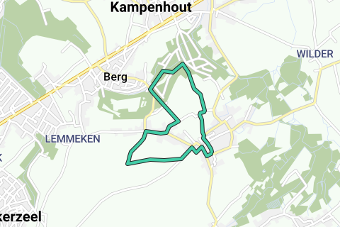
The route starts opposite St. Stephen's Church.
Signage: hexagonal white signs with red print
Parking lot at the church
Accessible by public transport: stop at the church
line 271 (Brussels-Kampenhout)
line 505 (Zaventem-Haacht)
line 514 (Steenokkerzeel-Tildonk)
line 700 dial-a-bus (Haacht-Kampenhout-Boortmeerbeek)
Parcourir l'itinéraire dans...
![]() Application RouteYou Ouvrez
Application RouteYou Ouvrez
Plus voir cette annonce?
→ Améliorez maintenant
![]()
Veuillez patienter, la navigation est en cours de préparation.
Vous pouvez maintenant naviguer. Amusez-vous en route!
Le traitement de votre requête a échoué. S'il vous plaît réessayez.
Plus voir cette annonce?
→ Améliorez maintenant
![]()
Veuillez patienter, votre téléchargement est en cours de préparation.
Votre téléchargement est prêt. Amusez-vous en route!
Le traitement de votre requête a échoué. S'il vous plaît réessayez.
Plus voir cette annonce?
→ Améliorez maintenant
![]()
Veuillez patienter, votre impression est en cours de préparation.
Votre impression est prête à être téléchargée. Amusez-vous en route!
Le traitement de votre requête a échoué. S'il vous plaît réessayez.
Plus voir cette annonce?
→ Améliorez maintenant
![]()
Veuillez patienter, votre téléchargement est en cours de préparation.
Votre téléchargement est prêt. Amusez-vous en route!
Le traitement de votre requête a échoué. S'il vous plaît réessayez.
<iframe src="https://plugin.routeyou.com/routeviewer/free/?language=fr&params.route.id=3027282&params.language=en" width="100%" height="600" frameborder="0" allowfullscreen></iframe>
<a href="https://www.routeyou.com/en-be/route/view/3027282/recreational-walking-route/laar-and-list-walk-in-kampenhout-nederokkerzeel?utm_source=embed&utm_medium=article&utm_campaign=routeshare" title="Laar and List walk in Kampenhout (Nederokkerzeel) - RouteYou" target="_blank"><img src="https://image.routeyou.com/embed/route/960x670/3027282-en@2x.png" width="960" height="670" alt="Laar and List walk in Kampenhout (Nederokkerzeel)"></a>
Commentaires supplémentaires:
Essayez cette fonctionnalité gratuitement avec un abonnement d'essai RouteYou Plus.
Si vous avez déjà un tel compte, connectez-vous maintenant.
Essayez cette fonctionnalité gratuitement avec un abonnement d'essai RouteYou Premium.
© 2006-2024 RouteYou - www.routeyou.com