Hainich is a forested hill chain in the state of Thuringia in Germany, between the towns of Eisenach, Mühlhausen and Bad Langensalza. Hainich covers an area of around 160 km² , of which, since 31 December 1997, half has been designated as Hainich National Park. The highest point in Hainich is Alte Berg at 1621 ft . The Mühlhäuser Stadtwald in the northern part of Hainich is the largest municipal forest in Thuringia. The landmark of Hainich is Betteleiche, a 600-year-old common oak at Ihlefeld.
Hainich is 18,6 mls long from north to south and 2,5 to 5 mls broad from west to east. The western edge of Hainich leads to Lempertsbach and Lauterbach valley and is steeper than the eastern slope. In the northwest you can find high rocks like Sommerstein and Winterstein. The reason for the steeper slopes in western Hainich is the Saalfeld-Gotha-Eichenberg fault. Because of limestone the Hainich creeks are dry for the most time of the year. In the east of Hainich water rises up in strong sources like Kainspring or Popperöder Quelle. So Hainich is a karst region.
Font: Wikipedia.org
Drets d'autor: Creative Commons 3.0
![]() | | Pública | Alemany • Francès • Neerlandès
| | Pública | Alemany • Francès • Neerlandès
Unstrut-Hainich-Kreis, Alemanya
Descobriu les rutes més boniques i conegudes de la zona, acuradament agrupades en seleccions adequades.
Font: Michael Fiegle
Drets d'autor: Creative Commons 3.0
Descobriu els llocs d'interès més bonics i coneguts de la zona, acuradament agrupats en seleccions adequades.
Font: Michael Fiegle
Drets d'autor: Creative Commons 3.0
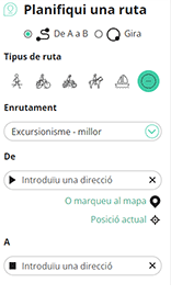
Amb RouteYou pots crear mapes personalitzats molt fàcilment. Defineix la teva ruta, afegeix waypoints o interseccions, planifica parades a punts d'interès o a establiments per menjar i beure i comparteix-ho tot amb els amics i la família.
Planificador de rutes

<iframe src="https://plugin.routeyou.com/poiviewer/free/?language=ca&params.poi.id=1399240&params.language=en" width="100%" height="600" frameborder="0" allowfullscreen></iframe>
Proveu aquesta funcionalitat gratuïtament amb una subscripció de prova RouteYou Plus.
Si ja disposa d'aquest compte, connecteu ara.
© 2006-2024 RouteYou - www.routeyou.com