Risorsa: Bobjgalindo
Diritti d'autore: Creative Commons 3.0
13 visite | Pubblica
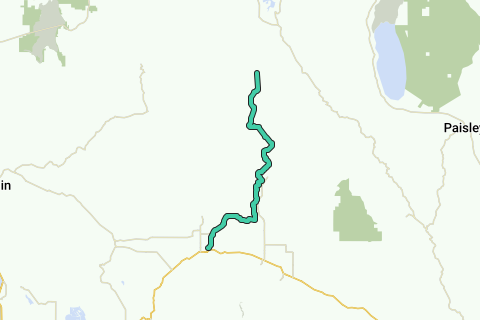
The OC&E Woods Line State Trail is a rail trail in Klamath and Lake counties in the U.S. state of Oregon. It is Oregon's longest state park. The trail follows the old OC&E (Oregon, California and Eastern) and Weyerhaeuser railroads from Klamath Falls to Thompson Reservoir. Along its 105-mile (169 km) length it passes through the communities of Olene, Sprague River, Dairy, Beatty, and Bly.
Inspired by OSM.
Naviga nel percorso in...
![]() App RouteYou Aprire
App RouteYou Aprire
Vuoi smettere di vedere questo annuncio?
→ Upgrade ora
![]()
Attendi, la navigazione è in preparazione.
Ora puoi navigare. Buon divertimento in viaggio!
Elaborazione della richiesta non è riuscita. Si prega di riprovare.
Vuoi smettere di vedere questo annuncio?
→ Upgrade ora
![]()
Attendi, il tuo download è in preparazione.
Il tuo download è pronto. Buon divertimento in viaggio!
Elaborazione della richiesta non è riuscita. Si prega di riprovare.
Vuoi smettere di vedere questo annuncio?
→ Upgrade ora
![]()
Attendi, la tua stampa è in preparazione.
La tua stampa è pronta per il download. Buon divertimento in viaggio!
Elaborazione della richiesta non è riuscita. Si prega di riprovare.
Vuoi smettere di vedere questo annuncio?
→ Upgrade ora
![]()
Attendi, il tuo download è in preparazione.
Il tuo download è pronto. Buon divertimento in viaggio!
Elaborazione della richiesta non è riuscita. Si prega di riprovare.
<iframe src="https://plugin.routeyou.com/routeviewer/free/?language=it&params.route.id=2046117&params.language=en" width="100%" height="600" frameborder="0" allowfullscreen></iframe>
<a href="https://www.routeyou.com/en-us/route/view/2046117/cycle-route/oc-e-line-state-trail-woods-spur?utm_source=embed&utm_medium=article&utm_campaign=routeshare" title="OC&E Line State Trail Woods Spur - RouteYou" target="_blank"><img src="https://image.routeyou.com/embed/route/960x670/2046117-en@2x.png" width="960" height="670" alt="OC&E Line State Trail Woods Spur"></a>
Altri commenti:
Prova questa funzionalità gratuitamente con un abbonamento di prova RouteYou Plus.
Se hai già un tale account, accedi ora.
Prova questa funzionalità gratuitamente con un abbonamento di prova RouteYou Premium.
© 2006-2024 RouteYou - www.routeyou.com