The Giesel is a roughly 10 km long left tributary of the Fulda, which originates in the district of Giesel at 409 m NN. Its primary upper course, also named Gresel, drains, together with its left tributary Saurode and its right tributary, also named Giesel, approximately the eastern half of the Giesel Forest, a large contiguous forest area covering 4,259.6 ha in the eastern part of the Lower Vogelsberg and west of the Fulda depression. It flows into the Fulda in the northern part of the Fulda district of Bronnzell, north and not far from the 215 m long sandstone bridge Kohlhäuser Brücke with over 10 arches at Kohlhaus. The longitudinal profile of the Giesel from its source to its confluence with the Fulda shows a height difference of 156 m.
Bron: Wikipedia.org
Auteursrechten: Creative Commons 3.0
 | | Publiek | Deens • Duits • Frans • Italiaans • Nederlands • Spaans
Adres: Fulda, Duitsland
Statistieken
Selecteer hieronder één van de populairste activiteiten of verfijn je zoekopdracht.
Ontdek de mooiste en meest populaire routes in de buurt, zorgvuldig gebundeld in passende selecties.
Selecteer hieronder één van de populairste categorieën of laat je inspireren door onze selecties.
Ontdek de mooiste en meest populaire bezienswaardigheden in de buurt, zorgvuldig gebundeld in passende selecties.
Met RouteYou kan je eenvoudig zelf aangepaste kaarten maken. Stippel je route uit, voeg waypoints of knooppunten toe, plan bezienswaardigheden en eet- en drinkgelegenheden in en deel alles met je familie en vrienden.
Routeplanner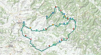
<iframe src="https://plugin.routeyou.com/poiviewer/free/?language=nl&params.poi.id=1381387&params.language=en" width="100%" height="600" frameborder="0" allowfullscreen></iframe>

Meer dan 11.800.000 routes

Meer dan 15.000.000 gebruikers

Meer dan 4.500.000 trekpleisters

Kerkstraat 108
9050 Gentbrugge, België
© 2006-2026 RouteYou - www.routeyou.com