

Autry is located some 50 km east of Reims and 25 km north by north-west of Sainte-Menehould. The southern border of the commune is the departmental boundary between Ardennes and Marne. Access to the commune is by road D21 from Challerange in the north-west which passes through the centre of the commune and the village and continues to Binarville in the south-east after changing to the D63 at the departmental border. The D218 goes west from the village to Bouconville and the D41 goes north-east to Lançon. Apart from the village there is the hamlet of La Gare in the west. Large areas of the commune are forested, especially in the west, and there is a large fish farm in the east. The rest of the commune is farmland.
Source: Wikipedia.org
Droits d'auteur: Creative Commons 3.0
 | | Public | Italien • allemand • catalan • danois • espagnol • français • néerlandais
Adresse: Autry, Champagne-Ardenne, France
Statistiques
Sélectionnez l'une des activités les plus populaires ci-dessous ou affinez votre recherche
Découvrez les plus beaux et les plus populaires itinéraires du secteur, soigneusement regroupés dans des sélections appropriées.
Source: François GOGLINS
Droits d'auteur: Creative Commons CC BY-SA 3.0
Sélectionnez l'une des catégories les plus populaires ci-dessous ou inspirez-vous de nos sélections
Découvrez les plus beaux et les plus populaires points d'intérêt du secteur, soigneusement regroupés dans des sélections appropriées.
Source: François GOGLINS
Droits d'auteur: Creative Commons CC BY-SA 3.0
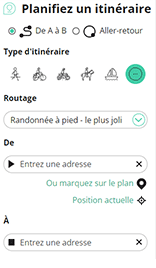
Avec RouteYou, vous pouvez facilement créer vos propres cartes personnalisées. Tracez votre itinéraire, ajoutez des points de passage ou des points-nœuds, planifiez des points d'intérêt et des lieux de restauration, et partagez le tout avec votre famille et vos amis.
Planificateur d'itinéraire
<iframe src="https://plugin.routeyou.com/poiviewer/free/?language=fr&params.poi.id=1333251&params.language=en" width="100%" height="600" frameborder="0" allowfullscreen></iframe>

Plus de 11 800 000 d'itinéraires

Plus de 15 000 000 d'utilisateurs

Plus de 4 500 000 de points d'intérêt

Kerkstraat 108
9050 Gentbrugge, Belgique
© 2006-2026 RouteYou - www.routeyou.com



