Link kopieret. Indsæt linket på Instagram for at dele ruten.

Pleasant jogging route with ample parking available on the north side.
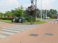
The exact running distance is 1550 m, almost 1 mile (1609 m), measured with a calibrated bicycle on the inside of the path (and the shortest distance between the curves). On the south side, you must leave the information board and the trash container on your left when running counterclockwise; thus, you go all the way up the hill behind the trees and the container, and do not take the shortcut.
There are picnic areas to the north and northeast. To the east, there is a bird-watching station (follow the stilts for this). From all four directions, there is a beautiful view of the fish pond.
In very wet weather, it can sometimes be slippery at the northern curve.
When running the loop counterclockwise, the (short) southern running direction is mostly uphill. The (longer) northern running direction then has two short inclines.
Har du lagt mærke til noget på denne rute?Tilføj et problem
Naviger ruten med...
 RouteYou app Åbn
Vil du ikke se denne annonce mere?
→ Opgrader nu

Et øjeblik, navigationen forberedes.
Du kan nu navigere. God fornøjelse på vejen!
Behandlingen af anmodningen mislykkedes. Prøv venligst igen.
Vil du ikke se denne annonce mere?
→ Opgrader nu
Et øjeblik, din download forberedes.
Din download er klar. God fornøjelse på farten!
Behandlingen af anmodningen mislykkedes. Prøv venligst igen.
Vil du ikke se denne annonce mere?
→ Opgrader nu
Et øjeblik, din udskrift forberedes.
Din udskrift er klar til download. God fornøjelse på farten!
Behandlingen af anmodningen mislykkedes. Prøv venligst igen.
Yderligere feedback:
Du skal mindst have en RouteYou PREMIUM-konto for at kunne bruge denne funktion.
Prøv nu 1 måned gratis og oplev forskellen! Vi beder ikke om betalingsoplysninger, og det stopper automatisk efter din prøveperiode på en måned.
© 2006-2026 RouteYou - www.routeyou.com


 wy


 Start
 Download
 Download


