Link kopieret. Indsæt linket på Instagram for at dele ruten.

 Azure
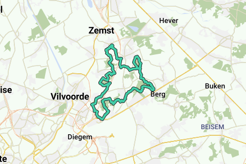
Forest route between Weerde and Brussels-Zaventem (32.2km): 5 forests, 3 castles and the recently built bicycle bridge over the E19 in Machelen are addressed (the longest in Flanders).
Walking/Walking/Cycling in the woods is not easy (Private property/closed and difficult to access/soggy). However, this loop is freely accessible everywhere!
Dry season: Ideal for family trip by bike or as a long endurance run.
Wet season: in some places in the Floordambos and the Hellebos it can be soggy. See below for the conditions.
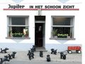
Departure and arrival of the loop at café Schoonzicht opposite the church in Weerde. You can also start in Machelen at the new bicycle bridge (dead end street Leuvensesteenweg in Machelen -good parking possibility-, or anywhere on the loop of course.
The loop goes counterclockwise through the five largest forests along the E19 between Weerde and Brussels-Zaventem; it passes three castles (Rubens Castle, Ravaart Castle, Ribaucourt Castle) and several large farms and other sights. In order, the following forests are cut from Weerde:
1. Weerde/Elewijt: Forest at the Rubens Castle (along the closed Barebeekmeander)
2. Houtem: White Children's Forest and native forest connected to the Houtembos (along the Kautesteenbeek).
3. Melsbroek (along the Trawool and the castle Ravaart) and Perk (along the Leibeek and Lopende beek): Floordambos
4. Perk (along the leibeek and Molenbeek) / Berg/Kampenhout (along the Torfbroekbeek): Hellebos. At the beginning of the Hellebos is the Castle de Ribaucourt.
5. Perk to Elewijt (along the Barebeek): Moorbos/Snijsselsbos.
This loop is not recommended with a road bike because all forests are located in low-lying areas around the indicated streams, and are therefore easily soggy in the wet season. Especially the Floordambos and the eastern part of the Hellebos excel in this.
However, the mapped loop is an all-weather loop for the recreationist without a mountain bike. The trail therefore runs along the 'driest' forest sections, so you can still get started with a regular city bike in winter. In the summer, most of the trail is dry. In any case, perfect to do with mountain bike. And there are a lot of asphalt strips / paved slopes between / in the woods). Also ideal for hikers with good footwear and runners who would like to train their intensity on a piece of unpaved forest road.
The photos in the 5 forests were taken in the winter so that you can see how the road is in the wet season.
The unpaved parts in the loop can be found in:
1. the Houtembos (not soggy in winter if you do not take the stakes to the left, and additionally keep to the right after the stakes);
2. the last part of the Floordambos, after the picks that you should take (very soggy in winter); The last part of the Floordam forest is quickly soggy, but you can avoid it: after the Chapel of Our Lady you have a pond to your right. Follow this pond on your right (see also the POI) into the field. After a few 100m you take the first left and you come to the path behind the soggy part of the forest.
3. the Hellebos (you can take a shortening through the northeastern part, but it is very soggy in winter. See the POIs;
4. the Moorbos/Snijsselsbos.
Note: When you have passed the Military Barracks of Peutie, cross the street straight ahead; It's like getting into residents' gardens. Don't worry, you can continue through, this is the extension of the Grensstraat. Once on asphalt, take the second right, and drive/walk further to the police station. Just behind this starts a spur of the Floordambos, take left there, but also keep the football fields on your left.
Har du lagt mærke til noget på denne rute?Tilføj et problem
Naviger ruten med...
 RouteYou app Åbn
Vil du ikke se denne annonce mere?
→ Opgrader nu

Et øjeblik, navigationen forberedes.
Du kan nu navigere. God fornøjelse på vejen!
Behandlingen af anmodningen mislykkedes. Prøv venligst igen.
Vil du ikke se denne annonce mere?
→ Opgrader nu
Et øjeblik, din download forberedes.
Din download er klar. God fornøjelse på farten!
Behandlingen af anmodningen mislykkedes. Prøv venligst igen.
Vil du ikke se denne annonce mere?
→ Opgrader nu
Et øjeblik, din udskrift forberedes.
Din udskrift er klar til download. God fornøjelse på farten!
Behandlingen af anmodningen mislykkedes. Prøv venligst igen.
Yderligere feedback:
Du skal mindst have en RouteYou PREMIUM-konto for at kunne bruge denne funktion.
Prøv nu 1 måned gratis og oplev forskellen! Vi beder ikke om betalingsoplysninger, og det stopper automatisk efter din prøveperiode på en måned.
© 2006-2026 RouteYou - www.routeyou.com


 wy


 Start
 Download
 Download


