
Link kopieret. Indsæt linket på Instagram for at dele ruten.

Takket være vores partner Gemeente Kortenberg får du gratis adgang til denne rute – OG du kan lære RouteYou PLUS at kende.
Opdag alle fordelene
The Keizerdelle hiking trail owes its name to the Keizerdelle, one of the field complexes between Steenokkerzeel, Berg, Nederokkerzeel, and the Peperstraat in Erps-Kwerps. It is commonly referred to as Kasdel.
Our Keizerdelle hiking trail starts at the village square in Erps-Kwerps.
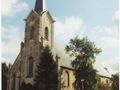
As a warm-up round, we walk around the church. There we already see some beautiful buildings: Restaurant Rooden Scilt, at the corner of Peperstraat and the village square, we see Café Central, to the left of Dorenbaan is the restored leased Hof Ackermans, and to the right is the old town hall of Erps-Kwerps. Directly opposite this town hall, there is a street running behind the choir of the church. Towards Paddestraat, there are three notable buildings: on the left the Erbehaus (formerly a rectory) and on the right the old rectory and Schavenberghof.
We continue our walk around the village square, reaching the fourth side of the square between Dekenijstraat and Kammestraat. We follow Kammestraat and turn right behind Walravenshof into Footpath 63 or Cnopsweg. This leads us to Frans Mombaersstraat, which we walk left almost to the end. About ten meters before the chapel of the Christ Child of Prague, we turn right into Nachbarsweg 11 or Keizerdelleweg. This is commonly known as the path to the Vosseputten. This Keizerdelleweg becomes a beautiful hollow road, which first crosses the extension of Curegemstraat (=Nachbarsweg 1). On the left, we notice the red-white DVOR BUB signal from the airport. Then, Keizerdelleweg also crosses Nachbarsweg 12 or Vosseputten. 200 meters further, we follow Paysweg or Nachbarsweg 10, which continues into Keizerdellestraat.
We can walk along this all the way to the end. When we then turn right into Peperstraat, we are quickly back at the village square, our starting point. We will have covered 5.3 km.
Or... if the legs are not yet tired, we can almost at the end of Keizerdellestraat turn left into Footpath 66 towards Dorenbaan for an extra 2.5 km. At Dorenbaan, we then turn left and follow this path until we reach a fork at the height of mountain bike post 53. Here, we sharply turn right into Nachbarsweg 6 or Lindekensweg, which leads to Nederokkerzeelsesteenweg directly opposite Kasteelstraat. Here, we turn right and walk down Nederokkerzeelsesteenweg, which transitions into Peperstraat, where we see the village square to the left, our starting point.
Har du lagt mærke til noget på denne rute?Tilføj et problem
Naviger ruten med...
 RouteYou app Åbn

Et øjeblik, din udskrift forberedes.
Din udskrift er klar til download. God fornøjelse på farten!
Behandlingen af anmodningen mislykkedes. Prøv venligst igen.
Yderligere feedback:
Du skal mindst have en RouteYou PREMIUM-konto for at kunne bruge denne funktion.
Prøv nu 1 måned gratis og oplev forskellen! Vi beder ikke om betalingsoplysninger, og det stopper automatisk efter din prøveperiode på en måned.
© 2006-2026 RouteYou - www.routeyou.com


 Gemeente Kortenberg


 Download


