Takket være vores partner haroldslegers får du gratis adgang til denne rute – OG du kan lære RouteYou PLUS at kende.
Opdag alle fordelene540 gange set | Offentlig | Fransk • Nederlandsk • Tysk
 Azure
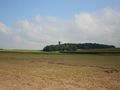
AzureThe route starts at the Neutorplatz car park in Sonsbeck and is walked counterclockwise. The route leads successively over the following ridges:
the Sonsbeck Switzerland (the beautiful moraine north of Sonsbeck), the Balbeck ridge (with large forest areas on the mountain ranges such as the Tüschenwald and the Uedemer Hochwald), the Pfalzdorfer Höhenrand (moraine between Kalkar and Uedem) and the route ends again in the Sonsbeck Switzerland.
The sections between the moraines/ridges are connected by flat land (farmland/meadows), which sometimes means that you have to follow cycle paths next to main roads (this is between Kalkar and Kehrum, just before Uedem, just before and after Sonsbeck and several hundred metres in Labbeck). The route also leads over the Boxteler Bahn, a well-paved exposed cycle path that partly follows the old railway line of the Boxteler Bahn. Near the town of Uedemerbruch, the route comes twice. The route also passes through Kalkar with its beautiful center (walk 50 meters from the route to visit the market square), but also through some ugly residential areas of Kalkar and the Vossegattweg, which has a moderate road surface in parts.
You get the following gradients for the wheels:
- Op den Hövel (one of the most beautiful climbs in the region),
- Sonsbecker Höhe (beautiful hollow road, called Dassendaler Weg. Note: after a descent, start sharply to the right!),
- Rosentalweg from Labbeck,
- Hufschenstraße
- Uedemer Hochwald followed by the cul-de-sac to the military radar station (good asphalt road without traffic),
- Kalkar Post Road ,
- Ginsterweg (beautiful hollow road over the edge of the Pfalzdorf height), no descent after the summit, but immediately followed by the Monreberg.
- Monreberg (cycle path along the main road Kalkar - Kehrum),
- Totenhügel Nord,
- Katzenberg (ascent to Uedem, second part on cycle path along the main road),
- Tüschenwald.
After the descent of the Tüschenwald, take another side road on the left in the lower part of the descent (St.-Annenweg), which climbs a few more meters upwards and you then descend the Knobsberg.
Har du lagt mærke til noget på denne rute?Tilføj et problem
Naviger ruten med...
![]() RouteYou app Åbn
RouteYou app Åbn
![]()
Et øjeblik, din udskrift forberedes.
Din udskrift er klar til download. God fornøjelse på farten!
Behandlingen af anmodningen mislykkedes. Prøv venligst igen.
<iframe src="https://plugin.routeyou.com/routeviewer/free/?language=da&params.route.id=10237195&params.language=en" width="100%" height="600" frameborder="0" allowfullscreen></iframe>
<p><a class="routeYou_embed" href="https://app.routeyou.com/en-de/route/view/10237195?utm_source=embed&utm_medium=article&utm_campaign=routeshare&navigation=external" title="Pfalzdorfer Höhenrand and Sonsbecker Schweiz - RouteYou" target="_blank"><img src="https://image.routeyou.com/embed/route/960x670/10237195-en@2x.png" style="width: 100%; height: auto;" alt="Pfalzdorfer Höhenrand and Sonsbecker Schweiz"></a></p>
Yderligere feedback:
Du skal mindst have en RouteYou PREMIUM-konto for at kunne bruge denne funktion.
Prøv nu 1 måned gratis og oplev forskellen! Vi beder ikke om betalingsoplysninger, og det stopper automatisk efter din prøveperiode på en måned.
© 2006-2025 RouteYou - www.routeyou.com