

The name Doorn is derived from Thorheim, which means residence of Thor, God of Thunder. Doorn is located at the transition from the Utrecht Hill Ridge to the lower-lying Kromme Rijn area. Burial mounds in the forests remind of ancient times. The first mention dates back to 855. In the Middle Ages, Doorn consisted of two knightly towns, Huis Doorn and Moersbergen Castle, along with many heathlands, fields, and forest areas. A historical postal route between Amsterdam and Arnhem ran through Doorn in the 17th and 18th centuries and likely followed a higher route via the Oude Arnhemse Bovenweg, Mariniersweg, Kampweg, Acacialaan, and Postweg. Previously, this road formed part of the medieval trade route, the Via Regia, from the diocese of Utrecht to imperial Cologne. This so-called 'heerweg', a road over which merchants traveled with their wagons, ran along the forests and wild lands of the Hill Ridge. In the 18th century, some construction occurred on the heath along the Amersfoortseweg, but due to the size of the estate around Huis Doorn, the village could not develop well. It was only after 1874, when the estate was subdivided, that it could grow. Even after World War II, the village experienced significant growth. A famous resident was German Emperor Wilhelm II. He was exiled in November 1918 and took up residence at Huis Doorn two years later. Author Simon Vestdijk lived a large part of his life at Torenlaan 4. Maarten Maartens, a celebrated author in the years 1890-1910, had a small castle, Zonheuvel, built in Doorn. Since 2006, Doorn (10,000 residents) has been the administrative center of the municipality of Utrechtse Heuvelrug, which includes several neighborhoods as well as Driebergen, Leersum, Amerongen, Maarn, Maarsbergen, and Overberg.
Datenquelle: Informatiegids gemeente Utrechtse Heuvelrug, blz 33, 2020
 | | Öffentlich | Deutsch • Dänisch • Französisch • Italienisch • Niederländisch • Spanisch

Wählen Sie eine der beliebtesten Aktivitäten unten aus oder verfeinern Sie Ihre Suche.
Entdecken Sie die schönsten und beliebtesten Routen in der Gegend, sorgfältig gebündelt in einer passenden Auswahl.
Datenquelle: Charles01
Urheberrechte: Public domain
Wählen Sie eine der unten aufgeführten beliebtesten Kategorien oder lassen Sie sich von unserer Auswahl inspirieren.
Entdecken Sie die schönsten und beliebtesten Sehenswürdigkeiten der Gegend, sorgfältig gebündelt in einer entsprechenden Auswahl.
Datenquelle: Charles01
Urheberrechte: Public domain
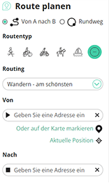
Mit RouteYou kannst du ganz einfach eigene Karten erstellen. Plane deine Route, füge Wegpunkte oder Knotenpunkte hinzu, plane Sehenswürdigkeiten und Einkehrmöglichkeiten ein und teile alles mit Familie und Freunden.
Routenplaner
<iframe src="https://plugin.routeyou.com/poiviewer/free/?language=de&params.poi.id=7469974&params.language=en" width="100%" height="600" frameborder="0" allowfullscreen></iframe>

Mehr als 10.100.000 Routen

Mehr als 15.000.000 Benutzer

Mehr als 4.500.000 Sehenswürdigkeiten

Kerkstraat 108
9050 Gentbrugge,Belgien
© 2006-2026 RouteYou - www.routeyou.com



