
Link kopiert. Fügen Sie den Link auf Instagram ein, um die Route zu teilen.


Dank unseres Partners Pasar vzw erhältst Du kostenlosen Zugang zu dieser Route - UND Du lernst RouteYou PLUS kennen.
Entdecke alle Vorteile
113272 Aufrufe | Öffentlich | Deutsch • Dänisch • Französisch • Italienisch • Niederländisch • Spanisch
 Azure
AzureThe Ninglinspo is a tributary of the Amblève near the Liège commune of Nonceveux near Remouchamps in the commune of Aywaille. It forms the lower course of the Hornay which has its source near the town of Vertbuisson in the commune of Theux.
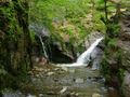
The Ninglinspo is the only mountain river in Belgium. It crosses an area classified since 1949. It is a place that purges its beauty of its wildness. Probably one of the most attractive places in Upper Belgium. The nature is exceptional, there is the possibility of swimming and you can enjoy beautiful views. The course of the Ninglinspo is about 3.5 km long, has an average decomposition of 7.5% and makes up a height difference of 200 meters. Source: Wikipedia
What could be more fun for children and hikers to admire its sculpted baths and nature in a playful way, to the rhythm of this beautiful mountain river? The place is on the list of special Walloon heritage monuments. Several marked walks start in the parking lot and lead through bridges and forest paths in front of beautiful viewpoints. Walk number 21 follows the Ninglinspo to the top. From the car park, follow the blue rectangle. On the way, you will come across baths called "Cascade de la chaudière" (185m), "Bain des Naïades" (215m), "Bain d'Hermès" (220m), "Bain de la Lotter" (295m), "Bain du Cerf" (305m), "Bain de Diane" (310m) or "Bain de Venus" (330m)! An unforgettable trip! Source: www.ourthe-ambleve.be
Geological hiking guide of the region: http://aow.kuleuven.be/geologie/ninglinspo/
Signage: blue rectangle 21
Start/finish: GPS Coordinates: 50.468609, 5.74354.
Parking: Auberge du Ninglinspo, Sedoz 5,
4920 Sougné-Remouchamps (Aywaille)
Ist Ihnen auf dieser Route etwas aufgefallen?Problem hinzufügen
Route navigieren in...
 RouteYou-App Öffnen

Bitte warten Sie, Ihr Ausdruck wird vorbereitet.
Ihr Ausdruck ist bereit für den Download. Viel Routen-Spaß!
Bearbeitung Ihrer Anfrage ist fehlgeschlagen. Bitte versuchen Sie es erneut.
Zusätzliches Feedback:
Diese Funktion ist ausschließlich für RouteYou PREMIUM-Abonnenten verfügbar.
Testen Sie 1 Monat kostenlos und entdecken Sie den Unterschied! Wir erfassen keine Zahlungsdaten und Ihre Testversion endet automatisch nach einem Monat.
© 2006-2026 RouteYou - www.routeyou.com



 Pasar vzw





 Herunterladen


