Enlace copiado. Pegue el enlace en Instagram para compartir la ruta.

Pleasant jogging route with ample parking available on the north side.
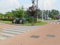
The exact running distance is 1550 m, almost 1 mile (1609 m), measured with a calibrated bicycle on the inside of the path (and the shortest distance between the curves). On the south side, you must leave the information board and the trash container on your left when running counterclockwise; thus, you go all the way up the hill behind the trees and the container, and do not take the shortcut.
There are picnic areas to the north and northeast. To the east, there is a bird-watching station (follow the stilts for this). From all four directions, there is a beautiful view of the fish pond.
In very wet weather, it can sometimes be slippery at the northern curve.
When running the loop counterclockwise, the (short) southern running direction is mostly uphill. The (longer) northern running direction then has two short inclines.
¿Has notado algo en esta ruta?Añadir un problema
Navegar ruta en...
 Aplicación RouteYou Abre
¿No quieres ver más este anuncio?
→ Mejorar ahora

Espere, se está preparando la navegación.
Ahora puede navegar. ¡Diviértete en el camino!
El procesamiento de la solicitud ha fracasado. Por favor, inténtelo de nuevo.
¿No quieres ver más este anuncio?
→ Mejorar ahora
Espere, se está preparando su descarga.
Su descarga esta lista. ¡Diviértete en el camino!
El procesamiento de la solicitud ha fracasado. Por favor, inténtelo de nuevo.
¿No quieres ver más este anuncio?
→ Mejorar ahora
Espere, se está preparando su impresión.
Su impresión está lista para descargarse. ¡Diviértete en el camino!
El procesamiento de la solicitud ha fracasado. Por favor, inténtelo de nuevo.
Comentarios adicionales:
Esta función está disponible únicamente para los suscriptores de RouteYou PREMIUM.
Pruébalo gratis durante 1 mes y descubre la diferencia. No pedimos datos de pago y se interrumpe automáticamente tras el periodo de prueba de un mes.
© 2006-2026 RouteYou - www.routeyou.com


 wy




 Comenzar
 Descargar
 Descargar


