

Autry is located some 50 km east of Reims and 25 km north by north-west of Sainte-Menehould. The southern border of the commune is the departmental boundary between Ardennes and Marne. Access to the commune is by road D21 from Challerange in the north-west which passes through the centre of the commune and the village and continues to Binarville in the south-east after changing to the D63 at the departmental border. The D218 goes west from the village to Bouconville and the D41 goes north-east to Lançon. Apart from the village there is the hamlet of La Gare in the west. Large areas of the commune are forested, especially in the west, and there is a large fish farm in the east. The rest of the commune is farmland.
Fuente: Wikipedia.org
Derechos de autor: Creative Commons 3.0
 | | Pública | Alemán • Catalán • Danés • Español • Francés • Italiano • Neerlandés
Dirección: Autry, Champagne-Ardenne, Francia
Estadísticas
Selecciona una de las actividades más populares a continuación o afina tu búsqueda
Descubre las rutas más bonitas y populares de la zona, cuidadosamente agrupadas y seleccionadas.
Fuente: François GOGLINS
Derechos de autor: Creative Commons CC BY-SA 3.0
Selecciona una de las categorías más populares a continuación o inspírate en nuestras selecciones
Descubre los lugares de interés más bonitos y populares de la zona, cuidadosamente agrupados y selecciondos.
Fuente: François GOGLINS
Derechos de autor: Creative Commons CC BY-SA 3.0
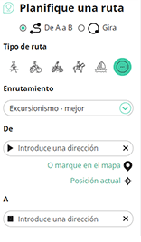
Con RouteYou, es fácil crear tus propios mapas personalizados. Simplemente traza tu ruta, agrega puntos de ruta o nodos, agrega lugares de interés, lugares para comer y beber, y luego compártelo fácilmente con tu familia y amigos.
Planificador de rutas
<iframe src="https://plugin.routeyou.com/poiviewer/free/?language=es&params.poi.id=1333251&params.language=en" width="100%" height="600" frameborder="0" allowfullscreen></iframe>

Más de 11.800.000 rutas

Más de 15.000.000 usuarios

Más de 4.500.000 lugares de interés

Kerkstraat 108
9050 Gentbrugge, Bélgica
© 2006-2026 RouteYou - www.routeyou.com



