Fuente: Jos van Nistelrooy
(Click on the bold words for more information, not available via the app, but available via the website.)
The current village Liessel is located on the eastern dune ridge along the Astense Aa. The higher elevation is clearly visible from the valley.
The earliest mention of Liessel dates back to 1312, when it consisted of a collection of farms. The participle “sel” could refer to the Old Dutch word sala, which meant a house building. Old Dutch was used until the middle of the Middle Ages, so approximately until 1000 AD. Another possibility is that “sel” is derived from the Germanic word lauhaz (loo), which means forest. Both derivations suggest that Liessel already existed before the landscape was significantly altered from the Full Middle Ages (11th – 13th century). From the 13th century, the population began to grow and new areas were brought into cultivation. On the high parts of the landscape, where habitation had already existed, the arable complexes emerged. Between these fields and the Astense Aa lay the meadows and hayfields.
Two prominent buildings are the Neo-Gothic St. Willibrorduskerk from 1901 and the belt mill “De Volksvriend”.
Fuente: Jos van Nistelrooy
 | | Pública | Alemán • Danés • Español • Francés • Italiano • Neerlandés

Selecciona una de las actividades más populares a continuación o afina tu búsqueda
Descubre las rutas más bonitas y populares de la zona, cuidadosamente agrupadas y seleccionadas.
Fuente: Jos van Nistelrooy
Selecciona una de las categorías más populares a continuación o inspírate en nuestras selecciones
Descubre los lugares de interés más bonitos y populares de la zona, cuidadosamente agrupados y selecciondos.
Fuente: Jos van Nistelrooy
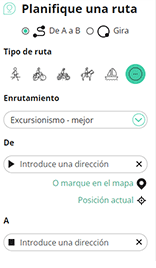
Con RouteYou, es fácil crear tus propios mapas personalizados. Simplemente traza tu ruta, agrega puntos de ruta o nodos, agrega lugares de interés, lugares para comer y beber, y luego compártelo fácilmente con tu familia y amigos.
Planificador de rutas
<iframe src="https://plugin.routeyou.com/poiviewer/free/?language=es&params.poi.id=9202024&params.language=en" width="100%" height="600" frameborder="0" allowfullscreen></iframe>

Más de 11.800.000 rutas

Más de 15.000.000 usuarios

Más de 4.500.000 lugares de interés

Kerkstraat 108
9050 Gentbrugge, Bélgica
© 2006-2026 RouteYou - www.routeyou.com



