

Gracias a nuestro socio Gemeente Kortenberg, puedes acceder gratis a esta ruta y conocer RouteYou PLUS.
Descubre todas las ventajas
Start
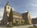
We leave the Our Lady Church in Kortenberg (more info: The Our Lady Church in Kortenberg).
Those arriving by public transport can use bus lines 352 (Kraainem-Leuven), 351 (Leuven-Brussels), 651 (Leuven-Zaventem), 528 (Tervuren-Kortenberg-Winksele), 530 (Kortenberg-Zaventem), 358 (Brussels-Leuven), 523 (Kortenberg-Heverlee), 652 (Zaventem-Leuven).
More info: www.delijn.be
For groups of hikers, there is a parking lot next to the Our Lady Church.
Attention! The small parking lot across from the church is a restricted parking zone (blue zone).
The Walk
Of course, you can join the hiking trail anywhere. But our starting point is at the Our Lady Church. We walk away from the main entrance of the church along the small parking lot in front of the church and follow Brouwerijstraat. At De Walsplein, we turn right. We do not cross the square but follow the road to the right along the houses. On De Walsplein, we see the municipal administrative center. At the end of the road is the entrance to the courtyard of a residential complex. In this courtyard stands the statue "Korte Broek" as a reminder of the former communal boys' school at this location. We exit the residential complex through the furthest passage and reach the traffic lights on Leuvensesteenweg via the stairs. Here we cross the street to Kapellestraat.
At the old Our Lady Chapel, which dates back to 1661, we turn left into Hofstraße. After 100 m, we take a right onto Guldendellestraat and follow this road (700 m) until the bridge over the railway, which we cross. We turn right and walk along the bike and footpath. At the end, we turn right under the viaduct over the railway. At the Boogstok parking lot of Kortenberg station, we take the railway tunnel on the right to reach Engelenstraat. We turn right into Engelenstraat and keep left to follow the street to the end. There, we briefly turn left and then immediately right to enter Blockmansstraat. We turn left into Parkstraat, which leads onto Stationstraat. We turn right and cross Leuvensesteenweg at the traffic lights. We go left and follow Leuvensesteenweg.
This heavily trafficked connecting road between Brussels and Leuven was built between 1706 and 1709 and divides the village in half. We pass some beautiful villas from the late 19th and early 20th centuries, including Villa Lurmann (house number 220) with its Art Nouveau-style wrought-iron gate.
After 500 m, we turn right into footpath 24. At the end, we turn right.
On the left, we see the gatehouse of the abbey. At the intersection, we turn left into Kiewitstraat. At the corner, we find the 18th-century rental building De Vierwegenscheden, once the Schuermans brewery.
We pass by Abdijdreef. Would you like to also see the 18th-century abbey castle (more info: The Abbey of Kortenberg) and the Veehof? Then feel free to walk along Abdijdreef.
We return on our steps and continue along Kiewitstraat. We walk past the old parish house, of which only the entrance gate is visible.
At the end of this hedge, we turn left into Wijngaardstraat. At the end of this street, we turn left into Colombastraat, heading towards the forest. At the last house, we turn right into the steep footpath 51. After a vigorous climb, we reach Groenstraat. We continue straight for a while until we reach Nachbarsweg 10, where we turn right.
We keep right, and after a slight ascent, we see the chapel dedicated to Our Lady of the Immaculate Conception.
This beautiful forest path leads into Vogelenzangstraat. We turn right and then at the first intersection, turn left into Mispelarenstraat. At the intersection, we cross over to Populierenlaan. After 250 m, we turn right into footpath 28. At the end, we turn right into Bosstraat and thus reach De Walsplein again, where we turn right into C. Schuermanslaan. We take the first street on the left. In Beekstraat, we turn into the second street on the left. Kloosterstraat brings us back to the Our Lady Church of Kortenberg.
¿Has notado algo en esta ruta?Añadir un problema
Navegar ruta en...
 Aplicación RouteYou Abre

Espere, se está preparando su impresión.
Su impresión está lista para descargarse. ¡Diviértete en el camino!
El procesamiento de la solicitud ha fracasado. Por favor, inténtelo de nuevo.
<iframe src="https://plugin.routeyou.com/routeviewer/free/?language=es&params.route.id=115026&params.language=en" width="100%" height="600" frameborder="0" allowfullscreen></iframe>
<p><a class="routeYou_embed" href="https://app.routeyou.com/en-be/route/view/115026?utm_source=embed&utm_medium=article&utm_campaign=routeshare&navigation=external" title="Colomba Hike - RouteYou" target="_blank"><img src="https://image.routeyou.com/embed/route/960x670/115026-en@2x.png" style="width: 100%; height: auto;" alt="Colomba Hike"></a></p>
Comentarios adicionales:
Esta función está disponible únicamente para los suscriptores de RouteYou PREMIUM.
Pruébalo gratis durante 1 mes y descubre la diferencia. No pedimos datos de pago y se interrumpe automáticamente tras el periodo de prueba de un mes.
© 2006-2026 RouteYou - www.routeyou.com



 Gemeente Kortenberg






 Descargar


