Fuente: Sandy Berthomieu
Derechos de autor: All rights reserved


Situated at the gates of the Gorges du Tarn and Jonte, at the confluence of the two rivers, the village takes its name from the rosebush cultures of the monks of the abbey of Aniane who built the church of Saint-Sauveur in 1705. All around they grew roses. This place then took the name of "Campus Rosarium". Called in Occitan "Lou Rousio", it is now called "Le Rozier". Today only the church remains of the monastery.
Opposite Le Rozier, on the other side of the Jonte, is the village of Peyreleau, located in Aveyron, the starting point to the Causse Noir. The village is tiered on the left bank of the river, and dominated by an old square tower, the last remnant of the old fortified castle.
Fuente: 48-CDT48
Derechos de autor: Creative Commons CC BY 2.0
 | | Pública | Alemán • Danés • Español • Francés • Italiano • Neerlandés
Dirección: 48150 Le Rozier
Estadísticas
Selecciona una de las actividades más populares a continuación o afina tu búsqueda
Descubre las rutas más bonitas y populares de la zona, cuidadosamente agrupadas y seleccionadas.
Fuente: Sandy Berthomieu
Derechos de autor: All rights reserved
Selecciona una de las categorías más populares a continuación o inspírate en nuestras selecciones
Descubre los lugares de interés más bonitos y populares de la zona, cuidadosamente agrupados y selecciondos.
Fuente: Sandy Berthomieu
Derechos de autor: All rights reserved
Con RouteYou, es fácil crear tus propios mapas personalizados. Simplemente traza tu ruta, agrega puntos de ruta o nodos, agrega lugares de interés, lugares para comer y beber, y luego compártelo fácilmente con tu familia y amigos.
Planificador de rutas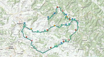
<iframe src="https://plugin.routeyou.com/poiviewer/free/?language=es&params.poi.id=8960771&params.language=en" width="100%" height="600" frameborder="0" allowfullscreen></iframe>

Más de 11.800.000 rutas

Más de 15.000.000 usuarios

Más de 4.500.000 lugares de interés

Kerkstraat 108
9050 Gentbrugge, Bélgica
© 2006-2026 RouteYou - www.routeyou.com