Fuente: Photo: Wikipedia
Cranborne Chase (grid reference ST970180) is a chalk plateau in central southern England, straddling the counties Dorset, Hampshire and Wiltshire. The plateau is part of the English Chalk Formation and is adjacent to Salisbury Plain and the West Wiltshire Downs in the north, and the Dorset Downs to the south west. The scarp slope of the hills faces the Blackmore Vale to the west, and to some extent the Vale of Wardour to the north. The chalk gently slopes south and dips under clays and gravels.
An area of 379 square miles (981 square kilometres) of Cranborne Chase and the West Wiltshire Downs has been designated an Area of Outstanding Natural Beauty (AONB), the sixth largest AONB in the country. The highest point is Win Green, in Wiltshire, at 910 ft (277 m).
Fuente: Wikipedia
 | | Pública | Neerlandés

Selecciona una de las actividades más populares a continuación o afina tu búsqueda
Descubre las rutas más bonitas y populares de la zona, cuidadosamente agrupadas y seleccionadas.
Fuente: Photo: Wikipedia
Selecciona una de las categorías más populares a continuación o inspírate en nuestras selecciones
Descubre los lugares de interés más bonitos y populares de la zona, cuidadosamente agrupados y selecciondos.
Fuente: Photo: Wikipedia
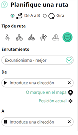
Con RouteYou, es fácil crear tus propios mapas personalizados. Simplemente traza tu ruta, agrega puntos de ruta o nodos, agrega lugares de interés, lugares para comer y beber, y luego compártelo fácilmente con tu familia y amigos.
Planificador de rutas
<iframe src="https://plugin.routeyou.com/poiviewer/free/?language=es&params.poi.id=7295879&params.language=en" width="100%" height="600" frameborder="0" allowfullscreen></iframe>

Más de 11.800.000 rutas

Más de 15.000.000 usuarios

Más de 4.500.000 lugares de interés

Kerkstraat 108
9050 Gentbrugge, Bélgica
© 2006-2026 RouteYou - www.routeyou.com



