1892 vues | Public | allemand • français • néerlandais
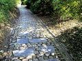
These 2 routes, which start from the church of Mont-Saint-Aubert, will challenge your calves! When you go down Mont de la Trinité and have to turn around, remind yourself that it's inevitable; you have to go back up the hill! Nevertheless, it is truly worth it, the view from the summit is extraordinary!
From the highest point of the Tournaisis at 149 meters, you have a splendid view of Tournai and the Escaut plain. Take advantage of the various viewpoints to capture your hike on film...
Option to extend your hike with the nearby RAVeL.
Vous avez remarqué quelque chose sur cet itinéraire ?Ajouter rapport
Parcourir l'itinéraire dans...
![]() Application RouteYou Ouvrez
Application RouteYou Ouvrez
Vous ne voulez plus voir cette publicité ?
→ Actualiser maintenant
![]()
Veuillez patienter, la navigation est en cours de préparation.
Vous pouvez maintenant naviguer. Bonne route !
Le traitement de la demande a échoué. Veuillez réessayer.
Vous ne voulez plus voir cette publicité ?
→ Actualiser maintenant
![]()
Veuillez patienter, votre téléchargement est en cours de préparation.
Votre téléchargement est prêt. Bonne route !
Le traitement de la demande a échoué. Veuillez réessayer.
Vous ne voulez plus voir cette publicité ?
→ Actualiser maintenant
![]()
Veuillez patienter, votre impression est en cours de préparation.
Votre impression est prête à être téléchargée. Bonne route !
Le traitement de la demande a échoué. Veuillez réessayer.
<iframe src="https://plugin.routeyou.com/routeviewer/free/?language=fr&params.route.id=337997&params.language=en" width="100%" height="600" frameborder="0" allowfullscreen></iframe>
<p><a class="routeYou_embed" href="https://app.routeyou.com/en-be/route/view/337997?utm_source=embed&utm_medium=article&utm_campaign=routeshare&navigation=external" title="On the northern slope of Mont-Saint-Aubert - RouteYou" target="_blank"><img src="https://image.routeyou.com/embed/route/960x670/337997-en@2x.png" style="width: 100%; height: auto;" alt="On the northern slope of Mont-Saint-Aubert"></a></p>
Commentaires supplémentaires :
Cette fonctionnalité est exclusivement disponible pour les abonnés RouteYou PREMIUM.
Essayez 1 mois gratuit maintenant et découvrez la différence ! Nous n'exigeons aucune donnée de paiement et le service s'arrête automatiquement après votre période d'essai d'un mois.
© 2006-2026 RouteYou - www.routeyou.com