10731 vues | Public | allemand • français • néerlandais
Hiking trail through the Wallebosk (approx. 5 km)
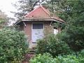
This hiking trail, marked with posts (white heads), starts at the Notariskoepel, which is located behind the town hall (a).
You reach the forest area south of Beetsterzwaag via the Freulesingel (b). The Freulesingel is named after Freiin Lycklama a Nijeholt (1845-1902), a resident and after the death of her father, owner of the Lycklamahus. This Singel used to be an access road to the fields and meadows located to the south, as well as the forests. The complex of Talant (c), formerly known as “t Hooghout,” is a facility for the mentally disabled and was built in 1971-72. At the end of the Freulesingel, we turn left into “die Walle.” The Walle is the eastern part of a very old dyke, which was created about a thousand years ago to protect against high water levels of the Koningsdieps, commonly called Ald Djip. Then you turn right and enter the forest area. A little further east, this dyke (water crown) connects to the higher-lying areas. The forest behind the Walle, the Wallebosk (d), was largely planted in the first half of the last century, mostly on poor agricultural soils. There used to be two very large and thick beeches at the end of the Molksingel (Melkerssingel) (d), which probably stood there before the Wallebosk was established. It is suspected that these beeches were spared during the reforestation. The “white” path leads us to the edge of the Mersken, the open valley of the Ald Djip. These moist, poorly fertilized meadows were once rich in plant species. The path you are currently on connects with the Koefenne and the Zandlaan, which is also referred to by some as Skjer. At the last path before the Zandlaan, the route turns north (left) and takes you back into the forest area. At the end of this forest path, you turn left and follow the marked route. At a “fork,” keep left, and after a few hundred meters, turn right and come to a pond that you can cross straight ahead over a long platform. This pond was created recently and will provide a suitable habitat for frogs, salamanders, and other aquatic creatures in due time. After crossing, continue on the path and come back to the Walle. Here you turn right and after about 200 m, turn left into the Zandlaan (f). The Zandlaan is a replacement for the old Herrenweg (Ald Hearrewei) which was previously located further to the east. This term was once used for roads of greater than local significance. South of the Ald Djip, the adjoining part of this formerly very important north-south connection is called Ald Hearrewei. (The Frisian term for old Herrenweg).
After a few hundred meters, you turn left into the built-up area of Beetsterzwaag and reach the Merkelan. If you continue straight ahead, you will return to the Freulesingel, where you turn right towards the starting point at the Notariskoepel.
a = Town hall b = Freulesingel c = Talant d = Melkerssingel e = die Walle f = Zandlaan
Vous avez remarqué quelque chose sur cet itinéraire ?Ajouter rapport
Parcourir l'itinéraire dans...
![]() Application RouteYou Ouvrez
Application RouteYou Ouvrez
Vous ne voulez plus voir cette publicité ?
→ Actualiser maintenant
![]()
Veuillez patienter, la navigation est en cours de préparation.
Vous pouvez maintenant naviguer. Bonne route !
Le traitement de la demande a échoué. Veuillez réessayer.
Vous ne voulez plus voir cette publicité ?
→ Actualiser maintenant
![]()
Veuillez patienter, votre téléchargement est en cours de préparation.
Votre téléchargement est prêt. Bonne route !
Le traitement de la demande a échoué. Veuillez réessayer.
Vous ne voulez plus voir cette publicité ?
→ Actualiser maintenant
![]()
Veuillez patienter, votre impression est en cours de préparation.
Votre impression est prête à être téléchargée. Bonne route !
Le traitement de la demande a échoué. Veuillez réessayer.
<iframe src="https://plugin.routeyou.com/routeviewer/free/?language=fr&params.route.id=298647&params.language=en" width="100%" height="600" frameborder="0" allowfullscreen></iframe>
<p><a class="routeYou_embed" href="https://app.routeyou.com/en-nl/route/view/298647?utm_source=embed&utm_medium=article&utm_campaign=routeshare&navigation=external" title="Wallebosk - RouteYou" target="_blank"><img src="https://image.routeyou.com/embed/route/960x670/298647-en@2x.png" style="width: 100%; height: auto;" alt="Wallebosk"></a></p>
Commentaires supplémentaires :
Cette fonctionnalité est exclusivement disponible pour les abonnés RouteYou PREMIUM.
Essayez 1 mois gratuit maintenant et découvrez la différence ! Nous n'exigeons aucune donnée de paiement et le service s'arrête automatiquement après votre période d'essai d'un mois.
© 2006-2026 RouteYou - www.routeyou.com