Grâce à notre partenaire haroldslegers, vous pouvez accéder gratuitement à cet itinéraire - et découvrir RouteYou PLUS.
Découvrez tous les avantages5848 vues | Public | allemand • français • néerlandais
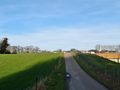
 Azure
AzureMany Dutch people who go south to go cycling in South Limburg drive to Valkenburg or even further into South Limburg. However, you can also start directly below Geleen and string together many climbs in the northern part of South Limburg.
Follow the track counterclockwise and start in Genhout, near Spaubeek. This is easily accessible via the A76 (exit Spaubeek). However, when driving home, there is no Spaubeek driveway to the west. You then have to drive to Neerbeek to take the slip road to the A76.
The first 9 km from Genhout it is warm cycling. You first cycle to Elsloo to descend over the cobblestones to the Maasdal (descent Maasberg). When you get down, you cycle past Elsloo Castle. Near Geulle, the Slingerberg first follows, then you descend Snijdersberg and then climb the Schieversberg.
Then you cycle towards Bunde and Schietecoven and descend the Biesenberg with completely renewed road surface in 2020 and a beautiful view of the hills that lie ahead. Then follows the ascent of the Visweg. After the descent to the Geul valley, you follow the Geul for a few kilometers on a dead end road for car traffic. When the weather is nice, it can be busy with hikers! You leave the Geuldal via the ascent of the Brakkeberg.
Then you set course for Bemelen (you descend the Bemelerberg), and then climb the road/cycle path to Groeve 't Rooth. Enjoy the peace and beautiful nature here and at the top of a great view over the large scar in the landscape: marl quarry 't Rooth. Then it goes in the direction of Valkenburg (by descending the Sibbergrubbe). The always busy Valkenburg is left via the ascent of the Goudsberg.
Via rural roads follow the climbs of the Holleweg Schin op Geul, the Achtbundersweg, the Vrouwendelweg (which gets steeper and steeper towards the end), the Colmont and the Hooggats (don't forget to look aside at the beautiful hidden village of Winthagen in the climb of the Hooggats).
Then follow some smaller climbs on very rural roads such as those of the Craubeek, Vink and the Nelisweg. When turning to Weustenrade you will see the castle Rivieren a few hundred meters in front of you. A few kilometers later you cycle past Wijnandsrade Castle.
The ride ends with the climbs on the northern edge of the Limburg plateau, namely the climbs of the Lindenweg and the Hobbelrade from Spaubeek. If you have anything left, you can make a detour from Spaubeek to the railway station and from there cycle to the steep Stammenderbos.
A variant of this route (which contains an extra loop that includes climbing the Stammenhof) can be found here .
N.B.: You cycle a few times on sunken roads, including on the plateau of Margraten (between the hamlet of 't Rooth and the village of Groot-Welsden). After a period of rain, sand that has been washed out of surrounding fields can collect on the sunken roads.
Vous avez remarqué quelque chose sur cet itinéraire ?Ajouter rapport
Parcourir l'itinéraire dans...
![]() Application RouteYou Ouvrez
Application RouteYou Ouvrez
![]()
Veuillez patienter, votre impression est en cours de préparation.
Votre impression est prête à être téléchargée. Bonne route !
Le traitement de la demande a échoué. Veuillez réessayer.
<iframe src="https://plugin.routeyou.com/routeviewer/free/?language=fr&params.route.id=4518206&params.language=en" width="100%" height="600" frameborder="0" allowfullscreen></iframe>
<p><a class="routeYou_embed" href="https://app.routeyou.com/en-nl/route/view/4518206?utm_source=embed&utm_medium=article&utm_campaign=routeshare&navigation=external" title="South Limburg close by - RouteYou" target="_blank"><img src="https://image.routeyou.com/embed/route/960x670/4518206-en@2x.png" style="width: 100%; height: auto;" alt="South Limburg close by"></a></p>
Commentaires supplémentaires :
Cette fonctionnalité est exclusivement disponible pour les abonnés RouteYou PREMIUM.
Essayez 1 mois gratuit maintenant et découvrez la différence ! Nous n'exigeons aucune donnée de paiement et le service s'arrête automatiquement après votre période d'essai d'un mois.
© 2006-2025 RouteYou - www.routeyou.com