Grâce à notre partenaire haroldslegers, vous pouvez accéder gratuitement à cet itinéraire - et découvrir RouteYou PLUS.
Découvrez tous les avantages1198 vues | Public | allemand • français • néerlandais
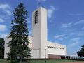
The starting point is the church of Mariadorp. Via Eijsden, you cycle to Belgium and follow the concrete cycling path/dike along the Albert Canal for kilometers.
You leave the Meuse Valley by climbing Montagne Saint-Pierre. The descent leads you into the valley of the Jeker. Along the valley of the Jeker (in French, this small river is called Geer), beautiful slopes are located. The language border is crossed several times. Characteristic of the region north of the Jeker (Haspengouw) are the many good concrete roads leading through fields (for the benefit of farmers). The wind has free rein here. The busier roads in the Jeker Valley are avoided by following separated cycling paths (including an asphalted cycling path along a former railway line) and by taking roads where only agricultural traffic is allowed.
Around the Jeker Valley, you will encounter the following ascents:
- Plattenberg (also known as Tiendeberg or Zusserdel), a beautiful climb over a winding road through the orchards.
- Côte de Wonck. At the end of May 2017, this road was partly blocked with concrete blocks because the rock face along the road became unstable. You can just pass it with your bike. So be careful here. This may have led to the one-way traffic from the slightly southern access of this climb being lifted (which would then serve as a good alternative). I am not aware of the situation here at the end of 2017.
- Sur Les Coteaux (average 4%, maximum 6%, and 1.8 kilometers long).
- Thier Saint Laurent
- Chavée Arecht / Arechtberg (max. 15%).
Afterward, you descend the western side of the Hallembaye on a narrow asphalted inner road, but be careful: at the bottom of the descent, there is a gate. Via the cycling path along the western side of the Albert Canal, you reach Hermalle-sous-Argenteau and cross the Meuse. You climb out of the Meuse Valley via Rue de Richelle. The following descent brings you to Dalhem and the Voer region where the Berwijn River (in French, Berwinne) has carved a significant relief. The two climbs in the Voer region (Clos du Grand Sart and the climb to Neufchateau) have the greatest altitude difference on this track. Enjoy the beautiful views after passing the village of Neufchateau! A long descent brings you to Warsage and soon back into Dutch-speaking territory.
Vous avez remarqué quelque chose sur cet itinéraire ?Ajouter rapport
Parcourir l'itinéraire dans...
![]() Application RouteYou Ouvrez
Application RouteYou Ouvrez
![]()
Veuillez patienter, votre impression est en cours de préparation.
Votre impression est prête à être téléchargée. Bonne route !
Le traitement de la demande a échoué. Veuillez réessayer.
<iframe src="https://plugin.routeyou.com/routeviewer/free/?language=fr&params.route.id=4521884&params.language=en" width="100%" height="600" frameborder="0" allowfullscreen></iframe>
<p><a class="routeYou_embed" href="https://app.routeyou.com/en-nl/route/view/4521884?utm_source=embed&utm_medium=article&utm_campaign=routeshare&navigation=external" title="Slopes along the Jeker Valley, Meuse Valley, and Berwijn Valley - RouteYou" target="_blank"><img src="https://image.routeyou.com/embed/route/960x670/4521884-en@2x.png" style="width: 100%; height: auto;" alt="Slopes along the Jeker Valley, Meuse Valley, and Berwijn Valley"></a></p>
Commentaires supplémentaires :
Cette fonctionnalité est exclusivement disponible pour les abonnés RouteYou PREMIUM.
Essayez 1 mois gratuit maintenant et découvrez la différence ! Nous n'exigeons aucune donnée de paiement et le service s'arrête automatiquement après votre période d'essai d'un mois.
© 2006-2025 RouteYou - www.routeyou.com