Lien copié. Collez le lien dans Instagram pour partager l'itinéraire.

 Azure
This 17 km loop takes an unusually slow road from Weerde (with some details) to the Vrijbroekpark in Mechelen, and returns to the starting point along the Zennejaagpad.
Also perfect to do by bike.
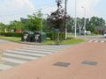
The starting point of the drawn loop is at the glass containers south of the Visput van Weerde. Via the east side and the Gulderij (2x under a railway) we cross the Brusselsesteenweg and follow the old Brusselsesteenweg to the left of the bridge over the E19.
At the end we do not take the towpath to the right of the Senne, but we take a left at the very end.
If you are very active, you can go up and down the hills on the left (sought after by mountain bikers and jumpers. Further on, when we leave the Senne, you can crack even higher hills.
But first you pass the 17th century chapel of Our Lady of the Hammeken, a disused pilgrimage site that is squeezed between the Zennemeanders and the E19. This protected monument exudes a sobriety on all sides, and from the Zennedijk it can be noticed that the Zennewater is regularly on her lips. Read about its interesting history and significance here:
http://books.google.be/books?id=h_YW4fKzu7UC&pg=PA4&dq=O.L.V.in+het+Hammeken&hl=nl&sa=X&ei=IE7WT4DLEJT88QPI5ICLAw&ved=0CDQQ6AEwAA#v=onepage&q=O.L.V.in%20het%20Hammeken&f=false
At this chapel you can follow it on the Zennedijk and northwards. The route shown shows the path closest to the E19. This is shorter, but sometimes a bit tricky in the summer. Eventually you come behind a meander also on the Zennedijk.
We pass the exit Mechelen-Zuid and a paved road with some houses. We'll leave this one on the right.
Suddenly very high sand hills appear on your right, take the right before this and go to the highway. You can climb up the highest hills on the southeast side (worth it!), which gives you a beautiful view of the Zennemeander, Eglegem pond and Mechelen. You can observe the typical water tower of Mechelen South, the Sint-Romboutstoren and other church towers nearby. Northeast of these artificially created hills we take the underpass under the E19, then left (across the railway line) until the traffic lights.
At the traffic lights take the right, straight onto the E19. Behind the third house on the left of the street, take the cul-de-sac on the left. To the right of this is a gateway to the provincial Vrijbroekpark (see the POI for the access hours). Take it, and immediately take the right over the bridge.
In the Vrijbroekpark we take the big loop of almost 3.4km by staying on the right, except when it is an exit. Two exceptions:
? If you notice a large water channel to your left, follow this water along the left, and you also keep this water on the left. If you have to cross a bridge, take it to the right, keep following that water on the right and leave the last water on your left.
? A little further there is a wooden bridge on the right to the 'Broekbos' (walk on staketsel). We don't take this one.
You take the same exit that you took when entering, this is after you have noticed the free-range dog meadow to your right.
On the stone road take left to and under the E19; and you take the Zennejaagpad on the left towards Weerde (west side). On the Brusselsesteenweg you continue to follow this towpath until you reach the Stationsstraat. Then turn left to Weerde.
Between the second and third railway bridge you take left, after which you go under the railway line on the right and immediately left back to the fish pit. At the fish pit you take the west side of the fish pit on the right, after which you turn off on the south side to your starting point.
Vous avez remarqué quelque chose sur cet itinéraire ?Ajouter rapport
Parcourir l'itinéraire dans...
 Application RouteYou Ouvrez
Vous ne voulez plus voir cette publicité ?
→ Actualiser maintenant

Veuillez patienter, la navigation est en cours de préparation.
Vous pouvez maintenant naviguer. Bonne route !
Le traitement de la demande a échoué. Veuillez réessayer.
Vous ne voulez plus voir cette publicité ?
→ Actualiser maintenant
Veuillez patienter, votre téléchargement est en cours de préparation.
Votre téléchargement est prêt. Bonne route !
Le traitement de la demande a échoué. Veuillez réessayer.
Vous ne voulez plus voir cette publicité ?
→ Actualiser maintenant
Veuillez patienter, votre impression est en cours de préparation.
Votre impression est prête à être téléchargée. Bonne route !
Le traitement de la demande a échoué. Veuillez réessayer.
Commentaires supplémentaires :
Cette fonctionnalité est exclusivement disponible pour les abonnés RouteYou PREMIUM.
Essayez 1 mois gratuit maintenant et découvrez la différence ! Nous n'exigeons aucune donnée de paiement et le service s'arrête automatiquement après votre période d'essai d'un mois.
© 2006-2026 RouteYou - www.routeyou.com


 wy




 Démarrer
 Télécharger
 Télécharger


