14918 vues | Public | allemand • français • néerlandais
 Azure
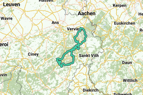
AzureThe initial intention of this route was to combine the 10 most difficult tracks in Belgium (source: "Encyclopedia Cotacol 1.000 – ISBN 1990/2925/2") into a single route. Unfortunately, the "Monty Triple Wall" as the 5th most difficult track in Lustin is too far away to be combined into one acceptable route. In the end, for the same reason, I decided to also remove the 10th most difficult slope from the route (although the "Rue sur Steppes" in Fraipont could probably be possible), so that the route consists of 8 of the 9 most difficult tracks in Belgium. Since the "Haussire" occurs twice (as the most difficult slope and the 8th most difficult, of course along 2 different sides), I named the route "TheSevenSummits".
In this description, I have put the following parameters in parentheses for all slopes of interest:
•Length
• Climbing altimeters
• Maximum slope
• Number of cotacol points
• Classification according to Cotacol
When you start the route in Spa, you climb the 8 steep slopes in this order:
Côte de la Baraque Michel Nord (13,500 m; 449 m; 13%; 336p; 3)
Côte de la Ferme Libert (1,250 m; 154 m; 20%; 311p; 7)
On the Stockeu (2,300 m; 227 m; 21%; 340 p; 2).
Les Hezalles (4,000 m; 229 m; 23%; 305p; 9).
Côte du Pied Monti (2,800 m; 179 m; 21%; 314 p; 6).
South Haussire (3,900 m; 273 m; 13%; 308p;8).
Haussire-South-West (4,600 m; 275 m; 14%; 363; 1).
Thier de Coo (2,600 m; 221 m; 17%; 322 p; 4).
Of all these tracks, I personally find the "Thier de Coo" the most difficult.
Between these tracks you have a constantly sloping route with a number of tracks recorded by Cotacol:
Surister Coast (2,200 m; 115 m; 10%; 106p; -): between Spa and Baraque Michel
Côte de Dochamps Ouest (8,000m; 312m; 10%; 258p; 35): after the second passage of the Haussire
Le Thier du Mont (2,500; 131; 18%; 134; -)
The High Lift (3,600 m; 202 m; 12%; 201p; 94): after the Thier de Coo
Côte du Rosier Est (4,500 m; 255 m; 12%; 202p; 90): after High Lift
Vous avez remarqué quelque chose sur cet itinéraire ?Ajouter rapport
Parcourir l'itinéraire dans...
![]() Application RouteYou Ouvrez
Application RouteYou Ouvrez
Vous ne voulez plus voir cette publicité ?
→ Actualiser maintenant
![]()
Veuillez patienter, la navigation est en cours de préparation.
Vous pouvez maintenant naviguer. Bonne route !
Le traitement de la demande a échoué. Veuillez réessayer.
Vous ne voulez plus voir cette publicité ?
→ Actualiser maintenant
![]()
Veuillez patienter, votre téléchargement est en cours de préparation.
Votre téléchargement est prêt. Bonne route !
Le traitement de la demande a échoué. Veuillez réessayer.
Vous ne voulez plus voir cette publicité ?
→ Actualiser maintenant
![]()
Veuillez patienter, votre impression est en cours de préparation.
Votre impression est prête à être téléchargée. Bonne route !
Le traitement de la demande a échoué. Veuillez réessayer.
<iframe src="https://plugin.routeyou.com/routeviewer/free/?language=fr&params.route.id=503505&params.language=en" width="100%" height="600" frameborder="0" allowfullscreen></iframe>
<p><a class="routeYou_embed" href="https://app.routeyou.com/en-be/route/view/503505?utm_source=embed&utm_medium=article&utm_campaign=routeshare&navigation=external" title="The Seven Summits - RouteYou" target="_blank"><img src="https://image.routeyou.com/embed/route/960x670/503505-en@2x.png" style="width: 100%; height: auto;" alt="The Seven Summits"></a></p>
Commentaires supplémentaires :
Cette fonctionnalité est exclusivement disponible pour les abonnés RouteYou PREMIUM.
Essayez 1 mois gratuit maintenant et découvrez la différence ! Nous n'exigeons aucune donnée de paiement et le service s'arrête automatiquement après votre période d'essai d'un mois.
© 2006-2025 RouteYou - www.routeyou.com