
Lien copié. Collez le lien dans Instagram pour partager l'itinéraire.

Grâce à notre partenaire Pasar vzw, vous pouvez accéder gratuitement à cet itinéraire - et découvrir RouteYou PLUS.
Découvrez tous les avantages
 Azure
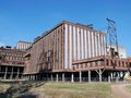
AzureAppointment at the parking (V) of the Flemish Mining Museum 1 in Beringen. Step through the museum gate (open: 9 a.m.-5 p.m.) and walk past the cafeteria at the entrance. Follow the red triangles and look on the left at the mosque of Beringen-Mijn. You step through a gate and a merry-go-round and cross the railway and a traffic road via a bridge. The red path goes straight ahead here, you follow the wide gravel road to the left. It goes up gently and soon you can look over the treetops. At the first opportunity, take the path that goes up on the right. At a second rest bench you are at a T-junction. Turn right here and continue to follow the winding path all the way to the top of terril 2. Here is a space demarcated where you can enjoy a 360° panorama. You can see the mine site, the church and the mosque of Beringen-Mijn and in clear weather much more. The viewing platform rises 100 m above the surroundings. As high as the Atomium, it is said here. Then return to your steps and descend the 93 stairs you have just climbed and walk again next to the Two Star Post with the poems to the point where you just came up. Continue walking straight ahead. Keep following the winding gravel road until you reach a fork with a periscope 3. One push of a button and a solar panel next to it ensures that you get a nice picture of the 'underworld'. Take the right-angled left turn and follow the red triangles again. At the fork, choose right and follow the path to a swing gate. Step through and you leave the mining site. Follow the asphalt road next to the closure to the left until you can take the first wide forest road on the right. The red triangle goes straight here. You step into the forest and don't care about side paths and keep walking straight until you can take the wide forest road on the right at a five-step jump. Keep following it straight ahead. Between a few concrete blocks you step out of the forest and you come to an asphalt road. Cross it and follow christmas street to the end. Turn right and at the chapel of Our Lady. from Rust turn left into the Hoekvoetweg. At the end turn left and then right into Neerstraat. Cross the Guido Gezellestraat and continue through the Neerstraat. Straight ahead it runs dead, so turn left, also here in the Neerstraat. Where the asphalt road bends right, you walk straight on the dirt road. On the T turn right until you reach the Zwarte Beek. Cross them and follow them to the right, past fields and occasionally a grove. You ignore the first road that goes over the stream. Continue walking until the path crosses the Zwarte Beek via a bridge and continue until you reach the Guido Gezellestraat again. Just past the Valentijnstraat (right) take the Stalse Molenstraat on the left. In front of you, the Stalse molen 4 is behind a meadow. At the fork it goes left to the mill. However, it is on private land. So turn right at the fork. Continue walking on the narrow asphalt road through the fields. At the T-junction, follow a busier road to the right. Leave the Guido Gezellestraat on the right and continue to the T with the white chapel. Just left and immediately right into the Steenstortstraat. Don't worry about side roads and step past some Turkish football fields. by Boudewijn Knevels turn right and you come to a concrete road. Right. You step past Mettecoven Mill, the name sign Mettekoven and ignore the Schildstraat on the right. Continue to the church with a beautiful square on the right. Immediately past the church, turn left onto the dirt road. There will also be a walk with an orange sphere. After a right turn, the path splits. Choose to the left and walk further through a sasje with two gates. Dogs must be on a leash here. It goes up firmly and after a bend you climb over a few steps. Then it continues quite flat and you step past a watchtower. Again through two gates and further over a narrow path and a bridge. Immediately afterwards you pass two new gates and it goes up again firmly. At the edge of the forest you are at the highest point. Walk on and step along a sasje into a tall orchard. No doubt: cherry trees according to the poem. Continue walking with the orange sphere and you will come to a road with two strips of concrete and a clinker strip in the middle. Left. Ignore a cul-de-sac on the right and continue to the 13th-century Helshoven Chapel 2. Turn right into Helshovenstraat. Past the nameplate of Hoepertingen and inn De Kluizenaar turn left into Helshovenstraat 14. Follow the rising road to the end at the T. Turn right into the gravel road. It quickly turns into a hollow road. Ignore a concrete road on the right and turn left at the crossroads, towards 170 for cyclists. Walk further under the bridge over which you started the walk earlier and cross the railway via the next narrow bridge. You can follow the red triangles again and walk through the Stationsstraat. In this Turkish area you walk past the Fatih Mosque 5, which you could see from afar. At the end of the Stationsstraat turn left until the departure point.
Vous avez remarqué quelque chose sur cet itinéraire ?Ajouter rapport
Parcourir l'itinéraire dans...
 Application RouteYou Ouvrez

Veuillez patienter, votre impression est en cours de préparation.
Votre impression est prête à être téléchargée. Bonne route !
Le traitement de la demande a échoué. Veuillez réessayer.
Commentaires supplémentaires :
Cette fonctionnalité est exclusivement disponible pour les abonnés RouteYou PREMIUM.
Essayez 1 mois gratuit maintenant et découvrez la différence ! Nous n'exigeons aucune donnée de paiement et le service s'arrête automatiquement après votre période d'essai d'un mois.
© 2006-2026 RouteYou - www.routeyou.com



 Pasar vzw






 Télécharger


