Gracias a nuestro socio Pasar vzw, puedes acceder gratis a esta ruta y conocer RouteYou PLUS.
Descubre todas las ventajas1947 visitas | Pública | Alemán • Francés • Neerlandés
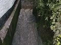
Welcome to the rural Aaigem, a district of Erpe-Mere. This hiking route takes you through Aaigemberg, the Molenbeek, the buffer pond, and the Wijngaardbos in a loop along the gently rolling course in the western part of Aaigem and the adjacent Ressegem.
Meet at the Sint-Niklaaskerk in Aaigem (Erpe-Mere), Aaigemdorp, opposite “Het Aaigems cafeetje”. The restored church tower dates from the late 13th century. Walk from the church via the Aaigems cafeetje towards Ratmolenstraat and go right downhill until Kosterweg. Turn left into Kosterweg and go straight until you cross the bridge over the Molenbeek (Erpenbeek). Continue straight until D'Hoeve and there continue straight into the field path. Follow the path until just before Dekkersveld (B&A Technics) and turn right there. Look back towards the village church. Turn right again and follow the path left to arrive at the Driepikkel. At Delestraat, go left uphill. At the height of Zakveldweg, continue left up Delestraat until Aaigembergstraat. You will notice the renovated chapel of Saint Anthony. Continue right into Aaigembergstraat. At an old farm, turn left into Eekhout. To your right, you will see a narrow path between the meadows. Turn right there. Ahead of us, we have a view of the beautiful rolling landscape. At the end of the path, go right along the concrete road and then turn left into Lammersweg. At the bridge over the Molenbeek (Erpenbeek) you will notice a buffer pond on your left. This pond is meant to prevent flooding further on. Continue along the gravel road to Otterkant in the territory of Ressegem (Herzele). Turn right onto the asphalt road. To your right, you see a riding school. Be cautious: a little further at the bend to the left, continue straight into the path. You will now pass an O.L.V. chapel. Then continue straight along Goezestraat and turn right into Paddenhoek a little further on. Go straight in Paddenhoek towards Wijngaardbos. You now walk along the forest until a T-junction. Turn left along the edge of the forest there. From there you will have a nice view of Aaigemdorp again. Continue along the gravel path and then turn right downhill. We arrive in Ashage with at the end a chapel (Saint Joseph) and a memorial for the crew of a Liberator that crashed in the area (1944). You will turn right twice via Opaaigem to Populierenstraat. At the end (chapel Saint Roch), turn right (Vijverage). A little further, you have a path with concrete pavers. Turn left there. Upon arriving in Griet, go right and a little further left along a concrete path (‘t Onderhof). The concrete path leads to Ratmolenstraat. Turn left there uphill via the OC Aaigem (old town hall). At the end of Ratmolenstraat, you will be back at the starting point.
¿Has notado algo en esta ruta?Añadir un problema
Navegar ruta en...
![]() Aplicación RouteYou Abre
Aplicación RouteYou Abre
![]()
Espere, se está preparando su impresión.
Su impresión está lista para descargarse. ¡Diviértete en el camino!
El procesamiento de la solicitud ha fracasado. Por favor, inténtelo de nuevo.
<iframe src="https://plugin.routeyou.com/routeviewer/free/?language=es&params.route.id=8059462&params.language=en" width="100%" height="600" frameborder="0" allowfullscreen></iframe>
<p><a class="routeYou_embed" href="https://app.routeyou.com/en-be/route/view/8059462?utm_source=embed&utm_medium=article&utm_campaign=routeshare&navigation=external" title="Along mountain, brook and forest in Aaigem - RouteYou" target="_blank"><img src="https://image.routeyou.com/embed/route/960x670/8059462-en@2x.png" style="width: 100%; height: auto;" alt="Along mountain, brook and forest in Aaigem"></a></p>
Comentarios adicionales:
Esta función está disponible únicamente para los suscriptores de RouteYou PREMIUM.
Pruébalo gratis durante 1 mes y descubre la diferencia. No pedimos datos de pago y se interrumpe automáticamente tras el periodo de prueba de un mes.
© 2006-2026 RouteYou - www.routeyou.com