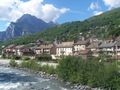
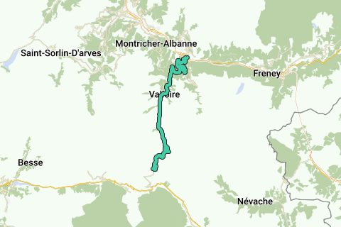
Climb to the Col de Galibier from Saint Michel de Maurienne, via Col de Télégraphe. The climb gets you to a height of 2642m over a length of about 35 km. The height difference from the start is 1933m. The average slope is 5.48% with max. slopes of 15%. The col is open from June till October.
Naviga nel percorso in...
![]() App RouteYou Aprire
App RouteYou Aprire
![]()
Attendi, la tua stampa è in preparazione.
La tua stampa è pronta per il download. Buon divertimento in viaggio!
Elaborazione della richiesta non è riuscita. Si prega di riprovare.
![]()
Attendi, il tuo download è in preparazione.
Il tuo download è pronto. Buon divertimento in viaggio!
Elaborazione della richiesta non è riuscita. Si prega di riprovare.
<iframe src="https://plugin.routeyou.com/routeviewer/free/?language=it&params.route.id=2005972&params.language=en" width="100%" height="600" frameborder="0" allowfullscreen></iframe>
<a href="https://www.routeyou.com/en-fr/route/view/2005972/road-bike-route/col-du-galibier-from-st-michel-de-mairienne?utm_source=embed&utm_medium=article&utm_campaign=routeshare" title="Col du Galibier from St.Michel de Mairienne - RouteYou" target="_blank"><img src="https://image.routeyou.com/embed/route/960x670/2005972-en@2x.png" width="960" height="670" alt="Col du Galibier from St.Michel de Mairienne"></a>
Altri commenti:
Prova questa funzionalità gratuitamente con un abbonamento di prova RouteYou Plus.
Se hai già un tale account, accedi ora.
Prova questa funzionalità gratuitamente con un abbonamento di prova RouteYou Premium.
© 2006-2024 RouteYou - www.routeyou.com