Risorsa: Rieno ✅ Routes
The Utrechtse Heuvelrug is a moraine that was formed in the penultimate ice age (238 to 126 thousand years ago). In this ice age, the Saalian period, the land ice sheet was located from Scandinavia to the ridge. The thick ice sheet had enormous power to carve out deep cavities (up to 100 meters deep). The sand from these cavities then pushed the ice sheet in front of it. In this way, high ridges could form in the landscape halfway through the Netherlands. As it warmed up, the ice sheet melted and the water found its way through the weak spots in the moraine. The water carved deep valleys in the subsurface, creating the icemelt water valleys on the south side of the ridge. A good example of this is the Darthuizerpoort northwest of Leersum.
The Utrechtse Heuvelrug has a multitude of landscape forms, such as beautiful forests, heaths, fens, shifting sands and floodplains. The highest point is the Amerongse Berg, 69.2 meters above sea level. In October 2003 it was officially granted the status of National Park. Through the National Park, the owners (Municipalities, Staatsbosbeheer, Het Utrechts Landschap, Natuurmonumenten and a number of private owners) strive to protect and improve nature, recreation and cultural-historical values. Until 2013, the northern border of the National Park was formed by the A12. In that year, it was extended to the A28.
Risorsa: wikipedia
![]() | | Pubblica | Olandese
| | Pubblica | Olandese
Scopri gli itinerari più belli e popolari della zona, accuratamente raggruppati in apposite selezioni.
Risorsa: Rieno ✅ Routes
Scopri i luoghi di interesse più belli e popolari della zona, accuratamente raggruppati in apposite selezioni.
Risorsa: Rieno ✅ Routes
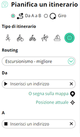
Con RouteYou puoi creare facilmente mappe personalizzate. Traccia il tuo itinerario, aggiungi waypoint o nodi, luoghi di interesse e di ristoro, e condividi le mappe con la tua famiglia e i tuoi amici.
Pianificatore di itinerari

<iframe src="https://plugin.routeyou.com/poiviewer/free/?language=it&params.poi.id=7453033&params.language=en" width="100%" height="600" frameborder="0" allowfullscreen></iframe>
Prova questa funzionalità gratuitamente con un abbonamento di prova RouteYou Plus.
Se hai già un tale account, accedi ora.
© 2006-2024 RouteYou - www.routeyou.com