50 visite | Pubblica
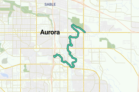
The High Line Canal is a man-made waterway, used for irrigation and recreation, that serves the Denver-Aurora Metropolitan Area. The High Line Canal (HLC) begins at a diversion dam on the South Platte River, some 1.8 miles (2.9 km) above the mouth of Waterton Canyon. From its headgate, the HLC runs 66 miles (106 km) to Green Valley Ranch, passing through Douglas, Arapahoe, and Denver Counties.
Inspired by OSM.
Naviga nel percorso in...
![]() App RouteYou Aprire
App RouteYou Aprire
Vuoi smettere di vedere questo annuncio?
→ Upgrade ora
![]()
Attendi, la navigazione è in preparazione.
Ora puoi navigare. Buon divertimento in viaggio!
Elaborazione della richiesta non è riuscita. Si prega di riprovare.
Vuoi smettere di vedere questo annuncio?
→ Upgrade ora
![]()
Attendi, il tuo download è in preparazione.
Il tuo download è pronto. Buon divertimento in viaggio!
Elaborazione della richiesta non è riuscita. Si prega di riprovare.
Vuoi smettere di vedere questo annuncio?
→ Upgrade ora
![]()
Attendi, la tua stampa è in preparazione.
La tua stampa è pronta per il download. Buon divertimento in viaggio!
Elaborazione della richiesta non è riuscita. Si prega di riprovare.
Vuoi smettere di vedere questo annuncio?
→ Upgrade ora
![]()
Attendi, il tuo download è in preparazione.
Il tuo download è pronto. Buon divertimento in viaggio!
Elaborazione della richiesta non è riuscita. Si prega di riprovare.
<iframe src="https://plugin.routeyou.com/routeviewer/free/?language=it&params.route.id=2055678&params.language=en" width="100%" height="600" frameborder="0" allowfullscreen></iframe>
<a href="https://www.routeyou.com/en-us/route/view/2055678/cycle-route/highline-canal-trail?utm_source=embed&utm_medium=article&utm_campaign=routeshare" title="Highline Canal Trail - RouteYou" target="_blank"><img src="https://image.routeyou.com/embed/route/960x670/2055678-en@2x.png" width="960" height="670" alt="Highline Canal Trail"></a>
Altri commenti:
Prova questa funzionalità gratuitamente con un abbonamento di prova RouteYou Plus.
Se hai già un tale account, accedi ora.
Prova questa funzionalità gratuitamente con un abbonamento di prova RouteYou Premium.
© 2006-2024 RouteYou - www.routeyou.com