

Wehrheim lies from 300 to 600 m above sea level on the north slope of the crest of the Taunus between Bad Homburg and Usingen im Taunus.
Wehrheim borders in the north on the town of Usingen and the community of Ober-Mörlen , in the east on the towns of Friedberg and Rosbach , in the south on the towns of Friedrichsdorf and Bad Homburg vor der Höhe, and in the west on the town of Neu-Anspach.
Risorsa: Wikipedia.org
Diritti d'autore: Creative Commons 3.0
Indirizzo: Wehrheim, Hochtaunuskreis, Germania
Statistiche
Seleziona una delle attività più popolari qui sotto oppure affina la ricerca.
Scopri gli itinerari più belli e popolari della zona, accuratamente raggruppati in apposite selezioni.
Risorsa: MdE
Diritti d'autore: Creative Commons CC BY-SA 3.0 de
Seleziona una delle categorie più popolari qui sotto o lasciati ispirare dalla nostra selezione.
Scopri i luoghi di interesse più belli e popolari della zona, accuratamente raggruppati in apposite selezioni.
Risorsa: MdE
Diritti d'autore: Creative Commons CC BY-SA 3.0 de
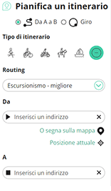
Con RouteYou puoi creare facilmente mappe personalizzate. Traccia il tuo itinerario, aggiungi waypoint o nodi, luoghi di interesse e di ristoro, e condividi le mappe con la tua famiglia e i tuoi amici.
Pianificatore di itinerari
<iframe src="https://plugin.routeyou.com/poiviewer/free/?language=it&params.poi.id=1386719&params.language=en" width="100%" height="600" frameborder="0" allowfullscreen></iframe>

Più di 11.800.000 itinerari

Più di 15.000.000 utenti

Più di 4.500.000 luoghi d'interesse

Kerkstraat 108
9050 Gentbrugge, Belgio
© 2006-2026 RouteYou - www.routeyou.com


 | | Pubblica |



