

The Bever is known as the "diligent river" in the Münsterland. Unlike most other rivers in this region, it carries a large volume of water with a steep gradient. From its source to its mouth, it drops by 25 meters. In East Bevern alone, the river drops by 4.5 meters. This gives it a sufficiently high potential energy. Since ancient times, mills have been operated on the Bever; there were disputes over water rights, dam height, and dam times. The water rights were mostly held by monasteries or noble estates. Until the 1950s, the Bever was dammed during the autumn months, which resulted in the entire Beverwiesen being flooded to have enough water for the operation of the mills over the winter. In the 1960s, these water rights were bought up by the maintenance associations, and the mill and dam operations were discontinued. Today, there are no mills operating on the Bever anymore.
Risorsa: Wikipedia
 | | Pubblica | Danese • Francese • Italiano • Olandese • Spagnolo • Tedesco
Indirizzo: Beverstrang 40 Glandorf, 48231 Warendorf, Nordrhein-Westfalen, Germania
Statistiche
Seleziona una delle attività più popolari qui sotto oppure affina la ricerca.
Scopri gli itinerari più belli e popolari della zona, accuratamente raggruppati in apposite selezioni.
Seleziona una delle categorie più popolari qui sotto o lasciati ispirare dalla nostra selezione.
Scopri i luoghi di interesse più belli e popolari della zona, accuratamente raggruppati in apposite selezioni.
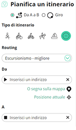
Con RouteYou puoi creare facilmente mappe personalizzate. Traccia il tuo itinerario, aggiungi waypoint o nodi, luoghi di interesse e di ristoro, e condividi le mappe con la tua famiglia e i tuoi amici.
Pianificatore di itinerari
<iframe src="https://plugin.routeyou.com/poiviewer/free/?language=it&params.poi.id=8188888&params.language=en" width="100%" height="600" frameborder="0" allowfullscreen></iframe>

Più di 11.800.000 itinerari

Più di 15.000.000 utenti

Più di 4.500.000 luoghi d'interesse

Kerkstraat 108
9050 Gentbrugge, Belgio
© 2006-2026 RouteYou - www.routeyou.com



