

Autry is located some 50 km east of Reims and 25 km north by north-west of Sainte-Menehould. The southern border of the commune is the departmental boundary between Ardennes and Marne. Access to the commune is by road D21 from Challerange in the north-west which passes through the centre of the commune and the village and continues to Binarville in the south-east after changing to the D63 at the departmental border. The D218 goes west from the village to Bouconville and the D41 goes north-east to Lançon. Apart from the village there is the hamlet of La Gare in the west. Large areas of the commune are forested, especially in the west, and there is a large fish farm in the east. The rest of the commune is farmland.
Risorsa: Wikipedia.org
Diritti d'autore: Creative Commons 3.0
 | | Pubblica | Catalano • Danese • Francese • Italiano • Olandese • Spagnolo • Tedesco
Indirizzo: Autry, Champagne-Ardenne, Francia
Statistiche
Seleziona una delle attività più popolari qui sotto oppure affina la ricerca.
Scopri gli itinerari più belli e popolari della zona, accuratamente raggruppati in apposite selezioni.
Risorsa: François GOGLINS
Diritti d'autore: Creative Commons CC BY-SA 3.0
Seleziona una delle categorie più popolari qui sotto o lasciati ispirare dalla nostra selezione.
Scopri i luoghi di interesse più belli e popolari della zona, accuratamente raggruppati in apposite selezioni.
Risorsa: François GOGLINS
Diritti d'autore: Creative Commons CC BY-SA 3.0
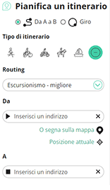
Con RouteYou puoi creare facilmente mappe personalizzate. Traccia il tuo itinerario, aggiungi waypoint o nodi, luoghi di interesse e di ristoro, e condividi le mappe con la tua famiglia e i tuoi amici.
Pianificatore di itinerari
<iframe src="https://plugin.routeyou.com/poiviewer/free/?language=it&params.poi.id=1333251&params.language=en" width="100%" height="600" frameborder="0" allowfullscreen></iframe>

Più di 11.800.000 itinerari

Più di 15.000.000 utenti

Più di 4.500.000 luoghi d'interesse

Kerkstraat 108
9050 Gentbrugge, Belgio
© 2006-2026 RouteYou - www.routeyou.com



