Link gekopieerd. Plak de link in Instagram om de route te delen.

Pleasant jogging route with ample parking available on the north side.
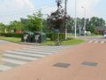
The exact running distance is 1550 m, almost 1 mile (1609 m), measured with a calibrated bicycle on the inside of the path (and the shortest distance between the curves). On the south side, you must leave the information board and the trash container on your left when running counterclockwise; thus, you go all the way up the hill behind the trees and the container, and do not take the shortcut.
There are picnic areas to the north and northeast. To the east, there is a bird-watching station (follow the stilts for this). From all four directions, there is a beautiful view of the fish pond.
In very wet weather, it can sometimes be slippery at the northern curve.
When running the loop counterclockwise, the (short) southern running direction is mostly uphill. The (longer) northern running direction then has two short inclines.
Iets opgevallen op deze route?Probleem toevoegen
Navigeer de route met...
 RouteYou app Open
Deze advertentie niet meer zien?
→ Upgrade nu

Even geduld, de navigatie wordt voorbereid.
Je kan nu navigeren. Veel plezier onderweg!
Het verwerken van de aanvraag is mislukt. Gelieve het opnieuw te proberen.
Deze advertentie niet meer zien?
→ Upgrade nu
Even geduld, je download wordt voorbereid.
Je download is klaar. Veel plezier onderweg!
Het verwerken van de aanvraag is mislukt. Gelieve het opnieuw te proberen.
Deze advertentie niet meer zien?
→ Upgrade nu
Even geduld, je afdruk wordt voorbereid.
Je afdruk is klaar om te downloaden. Veel plezier onderweg!
Het verwerken van de aanvraag is mislukt. Gelieve het opnieuw te proberen.
Bijkomende feedback:
Deze functionaliteit is exclusief beschikbaar voor RouteYou PREMIUM-abonnees.
Probeer nu 1 maand gratis en ontdek het verschil! We vragen geen betaalgegevens en het stopt automatisch na je proefperiode van een maand.
© 2006-2026 RouteYou - www.routeyou.com


 wy




 Starten
 Downloaden
 Downloaden


