

Pfofeld lies in the West Middle Franconia region, about five kilometres east of Gunzenhausen. In the north of the municipality are parts of the Großer Brombachsee and its forebay, the Kleiner Brombachsee, as well as the Altmühlüberleiter channel. In Roman times the limes ran through the area. The European watershed runs through the municipality and divides the catchments of the Rhine and Danube. A stream, the Dornhauser Mühlbach flows through Pfofeld; other local streams include the Bachwiesengraben, the Buxbach and the Brombach. The municipality is characterised by low hills and woods, including the Weißenberg and the Gräfensteinberg Forest. Staatsstraße 2222 runs past Pfofeld to the north. Within the municipality are the nature reserves of Brombachmoor and Halbinsel im Kleinen Brombachsee.
Bron: Wikipedia.org
Auteursrechten: Creative Commons 3.0
 | | Publiek | Deens • Duits • Frans • Italiaans • Nederlands • Spaans

Selecteer hieronder één van de populairste activiteiten of verfijn je zoekopdracht.
Ontdek de mooiste en meest populaire routes in de buurt, zorgvuldig gebundeld in passende selecties.
Bron: HaSe
Auteursrechten: Creative Commons CC BY-SA 4.0
Selecteer hieronder één van de populairste categorieën of laat je inspireren door onze selecties.
Ontdek de mooiste en meest populaire bezienswaardigheden in de buurt, zorgvuldig gebundeld in passende selecties.
Bron: HaSe
Auteursrechten: Creative Commons CC BY-SA 4.0
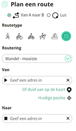
Met RouteYou kan je eenvoudig zelf aangepaste kaarten maken. Stippel je route uit, voeg waypoints of knooppunten toe, plan bezienswaardigheden en eet- en drinkgelegenheden in en deel alles met je familie en vrienden.
Routeplanner
<iframe src="https://plugin.routeyou.com/poiviewer/free/?language=nl&params.poi.id=8076771&params.language=en" width="100%" height="600" frameborder="0" allowfullscreen></iframe>

Meer dan 11.800.000 routes

Meer dan 15.000.000 gebruikers

Meer dan 4.500.000 trekpleisters

Kerkstraat 108
9050 Gentbrugge, België
© 2006-2026 RouteYou - www.routeyou.com



