Dankzij onze partner haroldslegers krijg je gratis toegang tot deze route – én maak je kennis met RouteYou PLUS.
Ontdek alle voordelen5001 keer bekeken | Publiek | Duits • Frans • Nederlands
 Azure
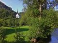
AzureThe route starts in Kreuzberg (Ahr), south of Altenahr (parking on Bahnhofstraße or at the hikers' car park just before the bridge over the Ahr).
The route is followed clockwise and initially goes a few kilometers on the cycle path in the Ahr valley, which is laid out over an old railway bed. You have to follow the busy main road for a few hundred meters before you turn off in the direction of Kesseling. It now goes continuously uphill, at first erroneously flat to Kesseling, and from Kesseling towards Adenau it gradually becomes a bit steeper (up to a maximum of 10%). Eventually, the route reaches an altitude of 620 meters.
Then we descend to the town of Adenau, which is located on the Nürburgring circuit. The city is left via an ascent to Barweiler. After Pomster, there is a longer but winding descent to Wirft. Once in Wirft, the route leads along farm roads (paved roads closed to car traffic, with the exception of agricultural traffic) to Rodder (this is a nice open climb).
After Rodder there is a steep descent (12%) to Antweiler, and in Antweiler you climb to the Aremberg. The subsequent descent will take you to Fuchshofen, where a nice climb awaits you (with 7 hairpin bends): it is steepest at the foot of the climb (12%), followed by a section of 2 km with gradients of 8 to 9%. For the next 3.5 kilometres, the road climbs much less steeply (around 4% on average).
A long descent takes you to Schuld and immediately follows another ascent (and then descent) to Insul. For a moment you follow the cycle path in the Ahr valley to avoid the busy roads in this valley, and then another nice climb to Plittersdorf follows: at first false flat, until suddenly you see a wall in Obliers: however, 6 consecutive hairpin bends have been made in the road, so the gradients here do not exceed 10%.
After Plittersdorf it goes down to Binzenbach in the valley of the Sahrbach. This valley is left via a climb with 5 hairpin bends. Finally, you come back to Kreuzberg via a beautiful descent.
Iets opgevallen op deze route?Probleem toevoegen
Navigeer de route met...
![]() RouteYou app Open
RouteYou app Open
![]()
Even geduld, je afdruk wordt voorbereid.
Je afdruk is klaar om te downloaden. Veel plezier onderweg!
Het verwerken van de aanvraag is mislukt. Gelieve het opnieuw te proberen.
<iframe src="https://plugin.routeyou.com/routeviewer/free/?language=nl&params.route.id=4419641&params.language=en" width="100%" height="600" frameborder="0" allowfullscreen></iframe>
<p><a class="routeYou_embed" href="https://app.routeyou.com/en-de/route/view/4419641?utm_source=embed&utm_medium=article&utm_campaign=routeshare&navigation=external" title="Guided tour of the Ahreifel - RouteYou" target="_blank"><img src="https://image.routeyou.com/embed/route/960x670/4419641-en@2x.png" style="width: 100%; height: auto;" alt="Guided tour of the Ahreifel"></a></p>
Bijkomende feedback:
Deze functionaliteit is exclusief beschikbaar voor RouteYou PREMIUM-abonnees.
Probeer nu 1 maand gratis en ontdek het verschil! We vragen geen betaalgegevens en het stopt automatisch na je proefperiode van een maand.
© 2006-2026 RouteYou - www.routeyou.com