The area of Middag Humsterland was once a sea with the salt marsh islands Humsterland and Middag. The islands were bordered by tidal channels that brought seawater inland during high tide. These incursions occurred from the western Lauwers Sea, now the Lauwersmeer, after it was reclaimed in 1969. The coastline used to reach the city of Groningen, but due to sedimentation in this area, the sea clay area became dry. This process was intensified after 1100 due to the continuous activity of reclamation.
 | | Publiek | Deens • Duits • Frans • Italiaans • Nederlands • Spaans

Selecteer hieronder één van de populairste activiteiten of verfijn je zoekopdracht.
Ontdek de mooiste en meest populaire routes in de buurt, zorgvuldig gebundeld in passende selecties.
Selecteer hieronder één van de populairste categorieën of laat je inspireren door onze selecties.
Ontdek de mooiste en meest populaire bezienswaardigheden in de buurt, zorgvuldig gebundeld in passende selecties.
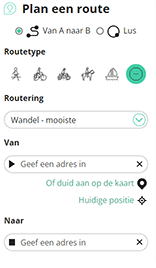
Met RouteYou kan je eenvoudig zelf aangepaste kaarten maken. Stippel je route uit, voeg waypoints of knooppunten toe, plan bezienswaardigheden en eet- en drinkgelegenheden in en deel alles met je familie en vrienden.
Routeplanner
<iframe src="https://plugin.routeyou.com/poiviewer/free/?language=nl&params.poi.id=576275&params.language=en" width="100%" height="600" frameborder="0" allowfullscreen></iframe>

Meer dan 11.800.000 routes

Meer dan 15.000.000 gebruikers

Meer dan 4.500.000 trekpleisters

Kerkstraat 108
9050 Gentbrugge, België
© 2006-2026 RouteYou - www.routeyou.com



