Auteursrechten: All rights reserved


Nouart is a rural municipality. It is indeed part of the municipalities that are sparsely or very sparsely populated, according to the density grid of the Insee. The municipality is also outside the attraction of cities. The land use of the municipality, as derived from the European database on biophysical land use Corine Land Cover, is characterized by the importance of agricultural areas, with a proportion roughly equivalent to that of 1990. The detailed distribution in 2018 is as follows: meadows, cropland, forests, heterogeneous agricultural areas, urbanized zones, and areas with shrub and/or herbaceous vegetation.
Bron: Wikipedia.org
Auteursrechten: Creative Commons 3.0
 | | Publiek | Catalaans • Duits • Frans • Italiaans • Nederlands • Spaans
Adres: Nouart, Champagne-Ardenne, Frankrijk
Statistieken
Selecteer hieronder één van de populairste activiteiten of verfijn je zoekopdracht.
Ontdek de mooiste en meest populaire routes in de buurt, zorgvuldig gebundeld in passende selecties.
Auteursrechten: All rights reserved
Selecteer hieronder één van de populairste categorieën of laat je inspireren door onze selecties.
Ontdek de mooiste en meest populaire bezienswaardigheden in de buurt, zorgvuldig gebundeld in passende selecties.
Auteursrechten: All rights reserved
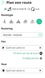
Met RouteYou kan je eenvoudig zelf aangepaste kaarten maken. Stippel je route uit, voeg waypoints of knooppunten toe, plan bezienswaardigheden en eet- en drinkgelegenheden in en deel alles met je familie en vrienden.
Routeplanner
<iframe src="https://plugin.routeyou.com/poiviewer/free/?language=nl&params.poi.id=1287635&params.language=en" width="100%" height="600" frameborder="0" allowfullscreen></iframe>

Meer dan 11.800.000 routes

Meer dan 15.000.000 gebruikers

Meer dan 4.500.000 trekpleisters

Kerkstraat 108
9050 Gentbrugge, België
© 2006-2026 RouteYou - www.routeyou.com



