

The A59 is a major road in England which is around 109 miles long and runs from Wallasey, Merseyside to York, North Yorkshire. The alignment formed part of the Trunk Roads Act 1936, being then designated as the A59. It is a key route connecting Merseyside at the M53 motorway to Yorkshire, passing through three counties and connecting to various major motorways. The road is a combination of historical routes combined with contemporary roads and a mixture of dual and single carriageway. Sections of the A59 in Yorkshire closely follow the routes of Roman roads, some dating back to the Middle Ages as salt roads, whilst much of the A59 in Merseyside follows Victorian routes which are largely unchanged to the present day.
Bron: Wikipedia.org
Auteursrechten: Creative Commons 3.0
 | | Publiek | Duits
Adres: Pendle, Verenigd Koninkrijk
Statistieken
Selecteer hieronder één van de populairste activiteiten of verfijn je zoekopdracht.
Ontdek de mooiste en meest populaire routes in de buurt, zorgvuldig gebundeld in passende selecties.
Bron: Joe Regan
Auteursrechten: Creative Commons CC BY-SA 2.0
Selecteer hieronder één van de populairste categorieën of laat je inspireren door onze selecties.
Ontdek de mooiste en meest populaire bezienswaardigheden in de buurt, zorgvuldig gebundeld in passende selecties.
Bron: Joe Regan
Auteursrechten: Creative Commons CC BY-SA 2.0
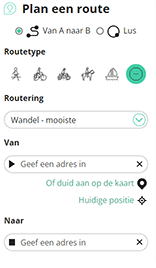
Met RouteYou kan je eenvoudig zelf aangepaste kaarten maken. Stippel je route uit, voeg waypoints of knooppunten toe, plan bezienswaardigheden en eet- en drinkgelegenheden in en deel alles met je familie en vrienden.
Routeplanner
<iframe src="https://plugin.routeyou.com/poiviewer/free/?language=nl&params.poi.id=1524988&params.language=en" width="100%" height="600" frameborder="0" allowfullscreen></iframe>

Meer dan 11.800.000 routes

Meer dan 15.000.000 gebruikers

Meer dan 4.500.000 trekpleisters

Kerkstraat 108
9050 Gentbrugge, België
© 2006-2026 RouteYou - www.routeyou.com



