Bottom Wood is a 14.5-hectare woodland in the English county of Buckinghamshire, located just north of the A40 near the hamlet of Studley Green. Since 1984, the wood has been owned by the Chiltern Society, which manages it as a nature reserve with the help of volunteers. Although an ancient woodland, most of the trees in the wood date from the end of the 1940s or later, as much of the wood was felled during the Second World War to produce Bryant and May matches. The wood is now home to a diverse range of flora and fauna, including rare species of butterfly and moth.
Bottom Wood is located north of the A40 between Piddington and Stokenchurch, north-east of Studley Green and east of Beacon's Bottom. It is within the parish of Radnage, with the southern boundary meeting the border of Stokenchurch parish and the eastern edge meeting the boundary with West Wycombe parish. The southern boundary of the wood also used to mark the border between the counties of Buckinghamshire and Oxfordshire, until county lines were redrawn in 1896.
Source: Wikipedia.org
Droits d'auteur: Creative Commons 3.0
![]() | | Publique
| | Publique
Wycombe, Royaume-Uni
Découvrez les itinéraires les plus jolis et les plus populaires de la région, soigneusement regroupés dans des sélections appropriées.
Source: Andrew Smith
Droits d'auteur: Creative Commons 2.0
Découvrez les lieux d'intérêt les plus jolis et les plus populaires de la région, soigneusement regroupés dans des sélections appropriées.
Source: Andrew Smith
Droits d'auteur: Creative Commons 2.0
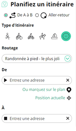
Avec RouteYou, il est facile de créer ses propres cartes personnalisées. Il vous suffit pour cela de tracer votre itinéraire, d'ajouter des points de passage ou des jonctions, d'inclure des lieux d'intérêt et des bars/restaurants pour une petite pause et de partager cet itinéraire avec votre famille et vos amis.
Planificateur d'itinéraires

<iframe src="https://plugin.routeyou.com/poiviewer/free/?language=fr&params.poi.id=1572767&params.language=en" width="100%" height="600" frameborder="0" allowfullscreen></iframe>
Essayez cette fonctionnalité gratuitement avec un abonnement d'essai RouteYou Plus.
Si vous avez déjà un tel compte, connectez-vous maintenant.
© 2006-2024 RouteYou - www.routeyou.com