Harter Fell is a fell in the western part of the English Lake District, located between the Eskdale and Duddon valleys. Its height is 649 m . There are several walking routes to the summit.
The headwaters of the Esk and Duddon are separated by a ridge falling south west from the summit of Crinkle Crags. This line of high ground continues over many twists and turns for 15 miles, finally meeting the sea on the slopes of Black Combe. From Crinkle Crags the first fells on this ridge are Hard Knott and Harter Fell, separated by Hardknott Pass. From Harter Fell the ridge continues over Green Crag, Great Worm Crag, Yoadcastle, Whitfell, Buck Barrow and Black Combe. Alfred Wainwright considered the latter hills unworthy of inclusion in his influential Pictorial Guide to the Lakeland Fells, stating that "south and west from Green Crag the scenery quickly deteriorates. This summit has therefore been taken as the boundary of fellwalking country." Later guidebook writers have disagreed, adding and the remainder of the range to their main volumes. Wainwright himself later relented and included these lesser hills in a supplementary volume, The Outlying Fells of Lakeland.
Fuente: Wikipedia.org
Derechos de autor: Creative Commons 3.0
![]() | | Pública | Alemán
| | Pública | Alemán
Copeland, Reino Unido
Descubre las rutas más bonitas y populares de la zona, cuidadosamente agrupadas y seleccionadas.
Fuente: Andy Beecroft
Derechos de autor: Creative Commons 2.0
Descubre los lugares de interés más bonitos y populares de la zona, cuidadosamente agrupados y selecciondos.
Fuente: Andy Beecroft
Derechos de autor: Creative Commons 2.0
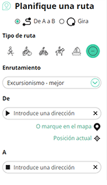
Con RouteYou, es fácil crear tus propios mapas personalizados. Simplemente traza tu ruta, agrega puntos de ruta o nodos, agrega lugares de interés, lugares para comer y beber, y luego compártelo fácilmente con tu familia y amigos.
Planificador de rutas

<iframe src="https://plugin.routeyou.com/poiviewer/free/?language=es&params.poi.id=1581446&params.language=en" width="100%" height="600" frameborder="0" allowfullscreen></iframe>
Pruebe esta funcionalidad gratis con una suscripción de prueba RouteYou Plus.
Si ya dispone de dicha cuenta, conectarse ahora.
© 2006-2024 RouteYou - www.routeyou.com