Risorsa: File Upload Bot (Magnus Manske)
Diritti d'autore: Creative Commons 3.0
Fort William and Mary was a colonial fortification in Britain's worldwide system of defenses, manned by soldiers of the Province of New Hampshire who reported directly to the royal governor. The fort, originally known as "The Castle", was situated on the island of New Castle, New Hampshire, at the mouth of the Piscataqua River estuary. It was renamed Fort William and Mary circa 1692, after the accession of the monarchs William III and Mary II to the British throne. It was captured by Patriot forces, recaptured, and later abandoned by the British in the Revolutionary War. The fort was renamed Fort Constitution in 1808 following rebuilding. The fort was further rebuilt and expanded through 1899 and served actively through World War II.
First fortified by the British prior to 1632, the fort guarded access to the harbor at Portsmouth and served as the colony's main munitions depot. The fort also served to protect Kittery, Maine, on the opposite shore, which was raided numerous times by the tribes of the Wabanaki Confederacy during the French and Indian Wars. Shadrach Walton commanded the fort during different periods at the end of the 17th and beginning of the 18th century.
Risorsa: Wikipedia.org
Diritti d'autore: Creative Commons 3.0
Rockingham
Scopri gli itinerari più belli e popolari della zona, accuratamente raggruppati in apposite selezioni.
Risorsa: File Upload Bot (Magnus Manske)
Diritti d'autore: Creative Commons 3.0
Scopri i luoghi di interesse più belli e popolari della zona, accuratamente raggruppati in apposite selezioni.
Risorsa: File Upload Bot (Magnus Manske)
Diritti d'autore: Creative Commons 3.0
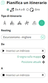
Con RouteYou puoi creare facilmente mappe personalizzate. Traccia il tuo itinerario, aggiungi waypoint o nodi, luoghi di interesse e di ristoro, e condividi le mappe con la tua famiglia e i tuoi amici.
Pianificatore di itinerari

<iframe src="https://plugin.routeyou.com/poiviewer/free/?language=it&params.poi.id=1456789&params.language=en" width="100%" height="600" frameborder="0" allowfullscreen></iframe>
Prova questa funzionalità gratuitamente con un abbonamento di prova RouteYou Plus.
Se hai già un tale account, accedi ora.
© 2006-2024 RouteYou - www.routeyou.com