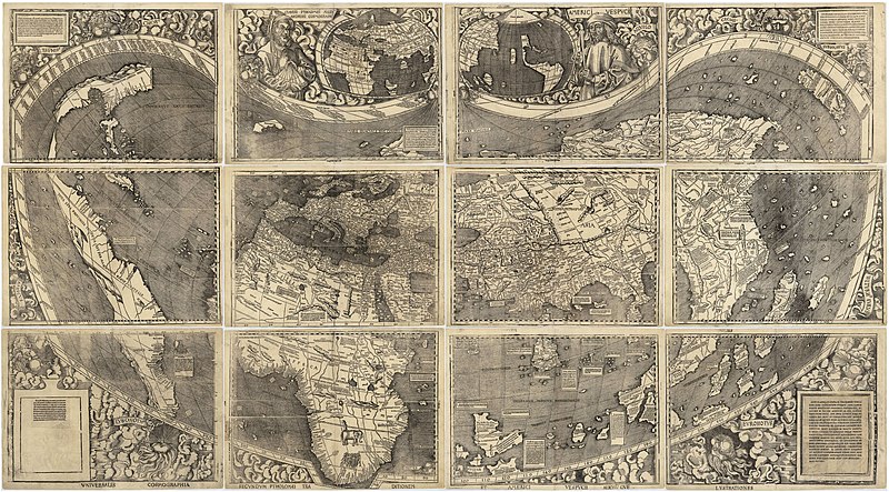
 Martin Waldseemueller Source Picture foto: Wikipedia |
The German priest Martin Waldseemueller, born in
Freiburg and working in Saint-Dié-des-Vosges, made
a very mysterious world map in 1507. He was drawing the the contours of South America's west coast years before Vasco Núñez de Balboa crossed the Isthmus of Panama and Ferdinand Magellan sailed around the bottom of the continent. At that time, the general idea was that America was connected to Asia. Waldseemueller did not only indicated there was a westcoast (and as such a vast ocean between America and Asia), but he indicated the location of the westcoast quite accurately, up to a 70% match. Which makes it very unlikely this was pure 'luck' and guesswork. Even more bizarre is the fact that in a later map, called Carta Marina, he withdrew this theory. The map shows South America no longer as an island. The continent disappears off the left of the page, implying it is attached to Asia. Was this a retraction? Was a continental America heresy? No evidence was found for this so far, but why would Waldseemueller change his pretty correct view to a wrong one? The mystery of Waldseemueller's map remains,.... You want to go and have a look at the map? A facsimile copy of the Waldseemüller map is prominently displayed in the Treasures Gallery of the Library of Congress in Washinton, D.C.Source: John W. Hessler of the Library of Congress |

