Revolutionary multi-media guide applications for iPhone!

29 January 2010, 00:00

Author: RouteYou

Public | DutchFrench

RouteYou & Geolives bring your routes to your iPhone
Geolives
Cooperation between Geolives and RouteYou results in
revolutionary multi-media guide applications for iPhone!

  • Geolives - the FREE entry version that allows to download and follow routes with limited editorial information.

  • Geolives-M - 'M'ULTIMEDIA commercial version (download price around € 5) that contains rich route information (text, photos, videos ...) with built-in text-to-speech voice synthesis for perfect reading of the POI (Point Of Interest) information.

  • Both applications can be obtained from your iPhone via the Apple Store.

GeoLives-M is an iPhone application
for searching and sharing audio tourist guides around the world! Hereby making use of Google Maps, or topographic maps, and a synthetic voice of professional high quality that can read your descriptive texts in over twenty languages.

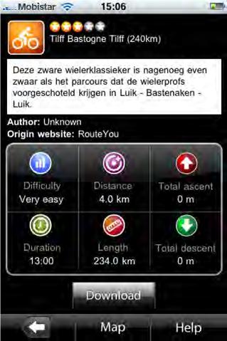
This application also allows you to register your own GPS tracks per type of activity and includes and automatic access to thousands of geo-referenced wikipedia articles!

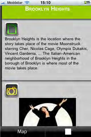
With the integrated GPS in your iPhone the text or photo's or Youtube Videos are automatically displayed/read when you come near to the POI.

The audio guides are quick to download and deliver an immediate and unique experience in the field! Fun, entertaining and informative!


Budget-friendly mobile Internet costs by using off-line option
(eg abroad)


Learn more about this revolutionary application?

Watch the introductory video

Guide: How to create own route guides on RouteYou and download them on my iPhone for use with the Geolives application?

Full Use Guide Geolives

Geolives

Urban Exploration, nature walk or family bike ride,
with Geolives-M
it is an enjoyable and educational experience for young and old
and you'll never get lost!
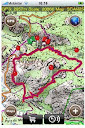
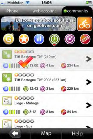

  • prepare Your trip on RouteYou and add the desired POI information.
  • download your routes on your iPhone
  • search available routes in your area (more than 180,000 already on RouteYou)
  • search according to type of activity, quality, proximity, duration, length ...
  • View the Points Of Interest (POIs) (represented by pins) associated with the downloaded routes.
  • Worldwide access to Google Maps and optional ordering (off-line) of detailed topographic maps for different European countries.

  • real-time information about the trip: distance, etc. ..
  • Save your own recorded tracks, categorized by type of activity
  • search for places, cities, monuments.. worldwide
  • acces Wikipedia POI (Point Of Interest) information
  • Once the route is downloaded to the device there is no further need for internet connection for tracking the path and hearing the POI texts (especially abroad this can save high mobile internet costs...) If you wish to see pictures or video clips connected to the POI's, you need on-line internet connection.


Some screenshots:


Related news

Comments

© 2006-2024 RouteYou - www.routeyou.com