South of Mexico City - Architour

Cycle route CultivArte - Cycle route South of Mexico City - Architour
otn_route_recommended

Owner: CultivArte
Region: Mexico
Linked groups: HistoryArcheologyArchitectureCityWorld heritageCultural heritageNature ParksPaved
star - Cycle route South of Mexico City - Architour | 722 views | Public

 
Need a hotel nearby?

South of Mexico City - Architour

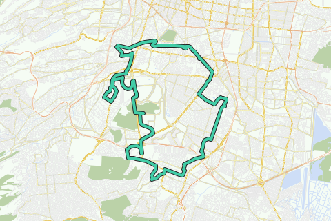
Although most visitors stick to the interesting historical center of the city, the southern part of the city is equally impressive, and can be perfectly explored by bike. This tour takes you through 2000 years of culture and architecture. From the first prehispanic settlements around the lake of the Valley of Mexico, to the colonial centers of Coyoacán, San Angel and Tlalpan, that were once an escape haven for the urban elite. You will equally visit modernist highlights of the 20th century: from a masterpiece of architect Luis Barragán, to the UNAM university campus, declared UNESCO World Heritage in 2007.

You want an overview of these and other architectural highlights of Mexico City which made mexican architecture world famous? Check out the guided Architour on http://www.ToursByLocals.com/MexicoCity-ArchiTour

Sponsored links


Statistics

General difficulty level

General difficulty score: 50/100.

Easy Difficult

Difficulty level in detail

Total ascent: 241 m
Difficulty level (relative): 5/10

Max. slope (base 500m): 4.61 %
Difficulty level (relative): 6/10

Length: 34 km
Difficulty level (relative): 3/10

This route on your website

More info


Places of interest (along the route) (show all)

Jardín Centenario (distance from start: 0 km/0 miles)

Jardín Centenario
After having destroyed old Tenochtitlan, Cortes settled down in Coyoacán, and considered for a while to make it the new capital of the New Spain colony. He made a deal with the local indigenous chief, Ixtolinque, and donated the land where the franciscans would build start the parish church dedicated to San Juan Bautista (a Saint highly revered by Cortes). The atrium and cementery of the church now form the two central squares. In Jardín Centenario, general Porfirio Diaz had a kiosk placed in 1910, to celebrate the centennial anniversary of the Independence of Mexico. The materials were brought from France and assembled here, with beautiful Art Nouveau ornaments. The eagle with the snake on top are still national symbols.

At this time, Coyoacán was for some years connected by an electric tram to the center of Mexico, and therefore became a popular recreational destination and second residence. However, the village-like feel is still present.

Author: jonazito

More information

Coyoacan fountain (distance from start: 0 km/0 miles)

Coyoacan fountain
This fountain refers to the time that Coyoacan was an important pre-Hispanic settlement: the place name glyph is a coyote. In the center of the coyote, which appears with curly or wet hair, is a circle which was a symbol of well water and also of Tezcatlipoca (the Prehispanic god of the smoking mirror), which also was related to the coyote.

Author: kaminotauro

More information

Centennal Kiosk (distance from start: 0 km/0 miles)

Centennal Kiosk
The kiosk was donated by Porfirio Diaz on the occasion of the Centennial celebrations in 1910. This type of gazebo construction (of Turkish origin) became fashionable in Europe during the nineteenth century, so that the bourgeoisie who used to go for a walk in the park to show off, would enjoy concerts. This one was designed in France. It has a small dome with a beautiful art nouveau cupula with stained glass and a bronze eagle that represents the Republic (it is said that the original gilded one mysteriously disappeared).

Author: kaminotauro

More information

Casa de Cortes - town hall (distance from start: 0.13 km/0.08 miles)

Casa de Cortes - town hall
This yellowish building, has nothing to do with the conquistador: he couldn't have occupied the house in times of conquest, as it was built in 1755. Possibly, its heirs have lived there. Inside, a mural of 1978 Diego Rosales (student and associate of Diego Rivera for 20 years) shows the conquest and the torture of the last Aztec emperor, Cuauhtemoc. Another mural in the Council room, by Aurora Reyes, shows the meeting between Cortés and Cuauhtémoc, among other significant events in local history.

Author: jonazito

More information

Cortes House (distance from start: 0.13 km/0.08 miles)

Cortes House
Contrary to popular belief, this building was built in 1755, and as such was never owned by the conqueror himself (who lived in the 1500s). Inside, a mural of 1978 Diego Rosales (student of Diego Rivera) shows scenes of the conquest. Another mural by Aurora Reyes, on the Board of Councils, shows the meeting between Cortés and Cuauhtémoc, the last Aztec emperor, among other significant events in local history.

Author: kaminotauro

More information

Casa Colorada - Red House (distance from start: 0.44 km/0.27 miles)

Casa Colorada - Red House
There is evidence that this building is located in the place where Cortes and his translator and lover Malinche once lived. It was so named because it is one of the few houses built of volcanic rock (and not of natural stone), with a typical red color, and decorated with ajaracas, a moorish influence brought here by the Spaniards. This rock is light, and widely available in the region. While facing the door, you can see that it is perpendicular to the entrance of the church across.

Author: jonazito

More information

La Conchita chapel (distance from start: 0.6 km/0.37 miles)

La Conchita chapel
This is the first place in the Valley of Mexico where Hernan Cortes hears Mass, accompanied by his translator and lover, La Malinche. The current building was completed in the early seventeenth century on the place of the original chapel. Its facade is baroque style with Moorish elements. Above the entrance a sun and moon can be distinguished, delicately carved in stone. The golden altar is churrigueresque style and contains the image of the Immaculate Conception.
Although in bad shape, this romantic place is still popular for weddings.

Author: jonazito

More information

Huayamilpas (distance from start: 4.41 km/2.74 miles)

Huayamilpas
This park has always been a natural deposit of water in the volcanic stone landshape, and one of the few remaining after the urbanization of Coyoacan. It has recently be restored to allow for a nice stroll around the water.

Huayamilpas (distance from start: 4.41 km/2.74 miles)

Huayamilpas
This park has always been a natural deposit of water in the volcanic stone landshape, and one of the few remaining after the urbanization of Coyoacan. It has recently be restored to allow for a nice stroll around the water.

Author: jonazito

More information

Anahucalli museum (distance from start: 5.47 km/3.4 miles)

Anahucalli museum
The building was designed by Diego Rivera, with elements of Aztec architecture, Teotihuacan, Maya and Xochicalco. It was designed as a sanctuary to hold of the huge collection of Mesoamerican objects, one of the obsessions of the painter. The interior has a study that was never used, since the building was completed by O'Gorman and Diego's daughter, Ruth Rivera Marín, after his death. Only a small fraction of the 58,000 pieces in the pre-Hispanic art collection is displayed. The zapotec figures are the most aesthetic of the collection.

Anahuacalli means "The house near the valley" in Nahuatl, as it is located on a hill. From the roof terrace, you get a nive view of the surroundings.

Author: jonazito

More information

Estadio Azteca (distance from start: 7.63 km/4.74 miles)

Estadio Azteca
Built in 1968 for the Olympic Games. It is an impressive concrete structure, designed by modern Mexican architect Pedro Ramirez Vazquez (who also built the Basilica of Guadalupe and the Museum of Anthropology, among other important buildings).
With a capacity of about 110,000 people, it was the seat of the soccer World Cups in 1970 and 1986, when Maradona scored his memorable goal against England (which is why he has a statue in front of the entrance). Until today, is the home stadium of Mexican clubs America and Atlante, and a concert stage for the most popular artists (mexican and foreign).

Author: jonazito

More information

Capilla de Barragán (distance from start: 10.68 km/6.64 miles)

Capilla de Barragán
This chapel for a small congregation of Capuchin Clares nuns, was built in the 1950s by Mexico's most famous architect, Luis Barragán. A profoundly religious man, he took care of part of the construction costs. He achieved here one of his masterpieces, playing skilfully with texture and light, combining colonial and modern style, creating as such an amazing mysticism.

Entering trough the simple door at Hidalgo 43, you pass a typical yellow wall with small square holes in it. The chapel walls have a rough, harsh texture and are painted bright lemon yellow. The floor is covered with planks of warm wood, reflecting the honey-coloured light that is filtered through a narrow window which indirectly illuminates the interior.
It passes a large, slender orange-painted crucifix from the side, so that its shadow falls on the altar. The place of prayer for the secluded nuns is separated from the main chapel by a painted wooden grid.

Author: jonazito

More information

Tlalpan main square (distance from start: 10.87 km/6.75 miles)

Tlalpan main square
This colonial square, dominated by the town hall, is a relatively undiscovered gem in the center of the biggest municipality of the Federal District, that reaches up to the Ajusco volcano on the outskirts of the city. It is a kind of mini-Coyoacán, with the occasional cantina (El Jalisciense), a bookshop (FCE) and lots of nice restaurants and cobble-stoned streets lined with colonial mansions.

Author: jonazito

More information

Fuentes Brotantes (distance from start: 12.38 km/7.69 miles)

Fuentes Brotantes
This must be one of the smallest national parks in Mexico, and it is a wonder it has withstood the urban sprawl. It is one of the small valleys or canyons that come down from the volcanic ridge south of the city, and its creeks and springs have formed some nice lakes. A perfect spot for people watching, and eating tasty country food at one of the populare eateries.

Author: jonazito

More information

Mercado de artesanías Vasco de Quiroga (distance from start: 14.18 km/8.81 miles)

Mercado de artesanías Vasco de Quiroga
This market specializes in wooden handcrafts, mostly furniture. If you want to get inspiration to refurbish your interior in mexican style, this is the place to be.

Peña Pobre (distance from start: 14.18 km/8.81 miles)

Peña Pobre
This little park is part of an industrial complex which once housed paper mills and other factories. You still can see some of the workers houses. Some nice concerts are organised here, or you can visit the shopping mall/cinema complex.

Author: jonazito

More information

Mercado de artesanías Vasco de Quiroga (distance from start: 14.18 km/8.81 miles)

Mercado de artesanías Vasco de Quiroga
This market specializes in wooden handcrafts, mostly furniture. If you want to get inspiration to refurbish your interior in mexican style, this is the place to be.

Author: jonazito

More information

Iglesia de Parques del Pedregal (distance from start: 15.37 km/9.55 miles)

Iglesia de Parques del Pedregal
This impressive modern building is home - suprisingly - to an ordinary parish church, though with an extraordinary full name: "La Esperanza de María en la Resurrección del Señor". It has two chapels and a space for urnes.

Author: jonazito

More information

Villa Olímpica (distance from start: 16.18 km/10.06 miles)

Villa Olímpica
This area of appartments was originally built to house the athletes during the Olympic Games of 1968. During the construction works, several remains of the great Cuicuilco culture were discovered (see the circular piramide on the opposite side of Insurgentes avenue), but could not be saved. You can also find a public sports center here.

Author: jonazito

More information

Warning: take the bridge to cross the avenue! (distance from start: 16.45 km/10.22 miles)

Warning: take the bridge to cross the avenue!

Cuicuilco (distance from start: 16.74 km/10.4 miles)

Cuicuilco
Enclosed by two main thoroughfares of the city, an ecological park has survived because it holds the remains of the Cuicuilco pre-hispanic culture. It consisted of several villages of loosely organized farmer-hunters who took advantage of the varied flora and fauna between the volcanic mountains and the lake shore. The piramid is one of the few discovered constructions, which functioned as an observatory of celestial bodies, so the priests could predict the agricultural calendar. It has a particular round shape and is over 23 meters tall. At the top are the remains of an altar. From here you have an excellent view of the Xitle, the volcanic cone just in front of the highest peak in the city, the Ajusco. An eruption of this volcano was responsible for the destruction of Cuicuilco during the first century of our era. Archeologists found ditches that were built by villagers in a vain attempt to divert the flow of lava from its ceremonial center. It is likely that emigration from this center to the Valley of Teotihuacan was one of the predominant factors of the spectacular development of that city in the following centuries. Some common features with prehispanic peoples in western Mexico (circular piramids, bottle-shaped tombs...), suggest a cultural link.

Author: jonazito

More information

MUAC - University Museum of Contemporary Art (distance from start: 18.83 km/11.7 miles)

MUAC - University Museum of Contemporary Art
This is the most recent crown jewel to complete the cultural area in the southern part of the UNAM University Campus. It was designed by famous Mexican architect Teodoro González de León, also autor of the Museo Rufino Tamayo in Chapultepec park.

Espacio Escultórico (distance from start: 19.5 km/12.12 miles)

Espacio Escultórico
This monumental piece was designed in 1979 by a team of sculpturers to pay tribute to the impressive surroundings of the volcanic ecological park, and the open space architecture of the pre-hispanic cultures. It is a site for contemplation, and ocasionally art performances take place here.

Author: jonazito

More information

UNAM - Central University Campus (distance from start: 21.72 km/13.5 miles)

UNAM - Central University Campus
This campus was designed in 1950 to replace the old buildings downtown that were getting too small and dispersed to accomodate the National University. With a team of 160 of the best architects of the moment, in a few year a complex was built that achieved a harmonic combination of functionalist modern architecture with pre-hispanic landscaping and decoration. Because of its architectural value, the Campus was declared World Heritage site in 2007.

UNAM hosts 31,000 academic staff, and about 300,000 students, and is as such one of the biggest in the world. A lot of famous scientists and politicians have studied in this maximum house of study.

The most remarkable buildings is the Central Library, a huge cubus decorated with 4000 square meters of coloured stone mosaic, representing the history of the country and the university. the Torre de Rectoria, built along the lines proposed by Le Corbusier, is also worthwile: it boasts three murals of David Alfaro Siquieros, one of the most influential Mexican painters from 1930 to 1960.

Author: jonazito

More information

Estadio Olímpico Universitario - Olympic University Stadium (distance from start: 21.8 km/13.54 miles)

Estadio Olímpico Universitario - Olympic University Stadium
The stadium was designed as a gigantic crater in a volcanic landscape in the 1950, and its entry was decorated with a mosaic mural of Diego Rivera. It represents the eagle and the condor of the university logo, a mexican family and dos athletes with the olympic torch, and a giant feathered snake, god of the aztecs.

The stadium was adapted for the Olympic Games in 1968 to host 69,000 fans. It is the home stadium of the Pumas Universitary Soccer Club.

Author: jonazito

More information

Jardines del Pedregal area & Mathias Göritz statue (distance from start: 23.61 km/14.67 miles)

Jardines del Pedregal area & Mathias Göritz statue
Famous modernist sculpturer and friend of mexican architect Luis Barragán that planned this residential area, made a zoomorphic figure to decorate the entrance. It is one of the few remaining elements of the original urban landscape, that has deteriorated a lot since the ambitious initial design for the better-off people of Mexico City. Most valuable modernist houses cannot be visited anymore because the streets have been fenced with guards at the entrance.

Author: jonazito

More information

Pedregal Church (distance from start: 25.58 km/15.89 miles)

Pedregal Church
This modernist church is a good example of the architectural style of the Jardines del Pedregal area, planned in the 1950s.

Pedregal Church (distance from start: 25.58 km/15.89 miles)

Pedregal Church
This modernist church is a good example of the architectural style of the Jardines del Pedregal area, planned in the 1950s.

Author: jonazito

More information

Ex Convento del Carmen (distance from start: 28.4 km/17.65 miles)

Ex Convento del Carmen
This was the most important monastery founded by the carmelites in Mexico. Their tradition to recreate the gardens of Mount Carmel after the foundation of the order in the 12th century, made the highly succesful in their economic endeavours (they obtained the permit to grow several crops protected by the Spanish Crown, such as citrus, peach and almonds). They also received much donations and legacies from rich Spaniards. Today, the museum boasts religious colonial art, information about the history of the carmelites, and some mummies in the cellars.

Author: jonazito

More information

Museo Casa del Risco (distance from start: 28.62 km/17.78 miles)

Museo Casa del Risco
This colonial house, renovated in the 20th century by Mexican diplomat Isidro Fabela, has a splendid baroque fountain in the patio, decorated with porcelain and talavera from Mexico and the Far East. Also the exhibits are worthwile a visit.

Author: jonazito

More information

San Jacinto (distance from start: 28.87 km/17.94 miles)

San Jacinto
This church was built by the dominicans at the end of the 16th century, on top of an existing chapel. Few years later, a monastery was added, that never succeeded to overshadow the important neighbour monastery of the carmelites. In the atrium, note the beautiful cross showing the elements of Christ's passion.

Museo Casa Estudio Diego Rivera (distance from start: 29.68 km/18.44 miles)

Museo Casa Estudio Diego Rivera
This house, designed by Rivera's friend O'Gorman in 1933 (also designer of the Central UNAM Library), is the first construction built in Mexico according to the principles of Le Corbusier (1929). It has two parts, the pink house for Diego, the blue one for his wife Frida. Rivera painted most of its 4000+ paintings here. Today the small museum gives a good idea of how he worked and lived.

Author: jonazito

More information

Carillo Gil (distance from start: 30.43 km/18.91 miles)

Carillo Gil
This modern building houses two floors of modern mexican painters and some work of the founder himself. Among the most interesting works of Diego Rivera is the cubist Maternidad, which he painted in Paris in 1916.

Author: kaminotauro

More information

San Antonio Panzacola (distance from start: 32.07 km/19.93 miles)

San Antonio Panzacola
This chapel was presumably built in the 17th century by a lady with smuggler sons. In gratitude that by miracle the police didn't find any of the smuggler ware during a control, she spent half of the profit on the chapel, and the rest to a more legal reorientation of her son's activities.

The medieval aspect is embellished by the nice entry, with Saint Sebastian on top, a populair saint because believed to protect against epidemics (which were widespread among the indigenous for a century after the conquest). To visit the baroque altarpiece, you have to come for early mass in weekends.

El Altillo (distance from start: 32.07 km/19.93 miles)

El Altillo
Here you find the remains of a big hacienda from the 18th century, owned by a noble family from Monterrey. In 1949, the buildings were donated to the Order of the Holy Spirit, who promptly decided to build a new church, designed by famous modernist architects. The result is stunning: a wide internal space under a floating hyperbolic concrete roof, with two entire walls covered by stained glass windows.

Fonoteca Nacional (distance from start: 32.32 km/20.08 miles)

Fonoteca Nacional
This colonial building is one of the finest in the Francisco Sosa street - at the end of the 19th century a mecca for intellectuals, when Coyoacán was called the "Athens of Mexico". Now it houses an institutions that conserves the sound archives of Mexico - from old songs to presidential speeches.

Santa Catalina Church (distance from start: 32.92 km/20.45 miles)

Santa Catalina Church
It was first built in the sixteenth century as an open chapel, a building style that facilitated the gathering of indigenous people to evangelize and to attend Catholic holidays. Later the roof was covered and the arches were closed. Today the church is painted in resplendent orange. Two arches have been reopened recently and covered with glass. The image of St. Catherine of Siena is in the stained glass window above the entrance.

Author: kaminotauro

More information

Colonial Arch (distance from start: 33.69 km/20.94 miles)

Colonial Arch
This double arch entrance to the old atrium of the convent of San Juan Bautista has tequitqui art columns (Spanish elements such as angels and vegetation elaborated by indigenous hands). On top you can see a medallion of the fransiscans, who initiated the construction of the church. The atrium wall was torn down after an incident of former revolutionary President Victoriano Huerta, who after a few drinks crashed his car into it.

Author: kaminotauro

More information

Francisco Sosa house and street (distance from start: 33.78 km/20.99 miles)

Francisco Sosa house and street
Francisco Sosa's house has a wooden door that has carved the initials FS, referring to its owner, surrounded by laurel leaves. It was the site of the famous literary circles of Coyoacan at the end of the nineteenth century, the beginning of the cultural fame which gave the neighboorhoud the nickname of "Athens of Mexico". Subsequently, the entire street lined with colonial houses was renamed from "Calle Real" (Royal Street, because it was an important connecting street with San Angel) to "Francisco Sosa"

Author: kaminotauro

More information

Places of interest (near the route)

Hotels nearby

Practical locations nearby

Nothing found

Comments

Nothing found

Sponsored links