
Font: ART op de Nederlandstalige Wikipedia
Drets d'autor: Creative Commons 3.0
The Hoekse Waard is an island between the Oude Maas, Dordtsche Kil, Hollands Diep, Haringvliet and Spui rivers in the province of South Holland in the Netherlands. The island, part of the namesake municipality of Hoeksche Waard, is a mostly agricultural region, south of the outskirts of Rotterdam. The Hoeksche Waard consists of reclaimed land : after the Saint Elisabeth flood of 1421 most of the area was flooded. The land has been reclaimed gradually in the following centuries.
Font: Wikipedia.org
Drets d'autor: Creative Commons 3.0
![]() | | Pública | Alemany • Espanyol • Francès • Italià • Neerlandès
| | Pública | Alemany • Espanyol • Francès • Italià • Neerlandès
Zuid-Holland, Zuid-Holland, Països Baixos

Seleccioneu una de les activitats més populars a continuació o perfeccioneu la cerca.
Descobriu les rutes més boniques i conegudes de la zona, acuradament agrupades en seleccions adequades.
Font: ART op de Nederlandstalige Wikipedia
Drets d'autor: Creative Commons 3.0
Seleccioneu una de les categories més populars a continuació o inspira't en les nostres seleccions.
Descobriu els llocs d'interès més bonics i coneguts de la zona, acuradament agrupats en seleccions adequades.
Font: ART op de Nederlandstalige Wikipedia
Drets d'autor: Creative Commons 3.0
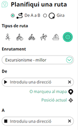
Amb RouteYou pots crear mapes personalitzats molt fàcilment. Defineix la teva ruta, afegeix waypoints o interseccions, planifica parades a punts d'interès o a establiments per menjar i beure i comparteix-ho tot amb els amics i la família.
Planificador de rutes

<iframe src="https://plugin.routeyou.com/poiviewer/free/?language=ca&params.poi.id=1644533&params.language=en" width="100%" height="600" frameborder="0" allowfullscreen></iframe>
Proveu aquesta funcionalitat gratuïtament amb una subscripció de prova RouteYou Plus.
Si ja disposa d'aquest compte, connecteu ara.
© 2006-2024 RouteYou - www.routeyou.com