Link copied. Paste the link into Instagram to share the route.

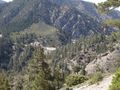
El Sendero Silver Moccasin es un sendero de 53 millas (85 km) ubicado en las Montañas de San Gabriel, justo al noreste de Los Ángeles. Comienza en el Área Recreativa Chantry Flat, sobre la ciudad de Arcadia, California, atravesando hacia arriba y hacia abajo a través de varios cañones y a lo largo de las altas crestas del Bosque Nacional de Ángeles. Este sendero conecta el Monte Baden-Powell, el Monte Burnham, el Pico Throop y el Monte Hawkins. Llega a su punto más alto de 9,399 pies (2,865 m) en el Monte Baden-Powell, después de lo cual desciende hacia su término en Vincent Gap en la Carretera Angeles Crest, cerca de Wrightwood.
Inspirado por OSM.
See something wrong on this route?Add an issue
Navigate route in...
 RouteYou app Open
Don't want to see this ad anymore?
→ Upgrade now

Please wait, the navigation is being prepared.
You can now navigate. Have fun on the road!
Processing your request has failed. Please try again.
Don't want to see this ad anymore?
→ Upgrade now
Please wait, your download is being prepared.
Your download is ready. Have fun on the road!
Processing your request has failed. Please try again.
Don't want to see this ad anymore?
→ Upgrade now
Please wait, your print is being prepared.
Your print is ready to download. Have fun on the road!
Processing your request has failed. Please try again.
Additional feedback:
This feature is only available to RouteYou PREMIUM subscribers.
Try 1 month for free and discover the difference! We don't take any payment details, and your trial ends automatically after one month.
© 2006-2026 RouteYou - www.routeyou.com


 Recreational USA & Canada




 Start
 Download
 Download


